“It’s like kayaking in the alpine.”
If you are a kayaker, Pacific Northwest is a blessed placed to be. Soooo many bays and coves, islands and islets to explore! One of my favourite kayaking trips of all times was paddling to the head of Jervis Inlet which cuts deep into the coast mountains. The scenery of rugged peaks lining the inlet is so scenic that Peter described it as “kayaking in the alpine”.
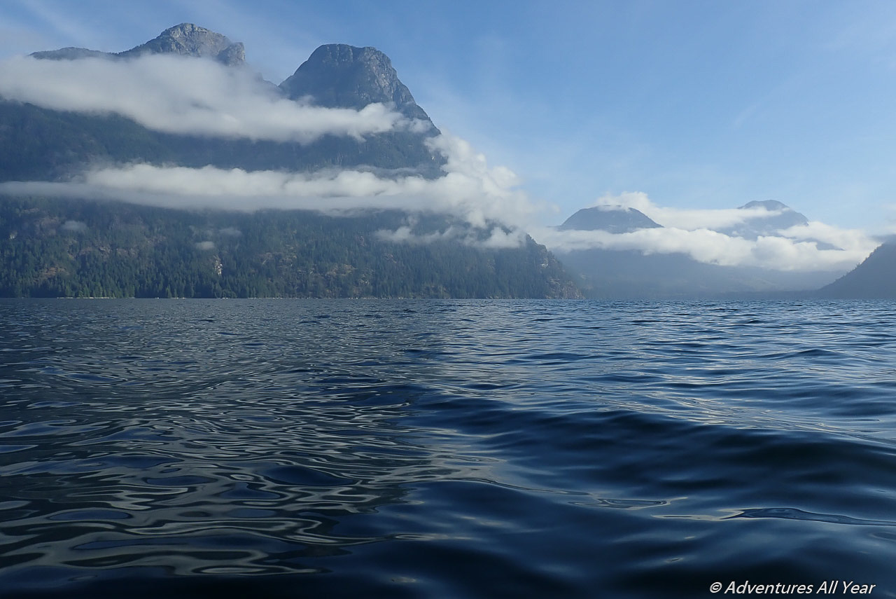
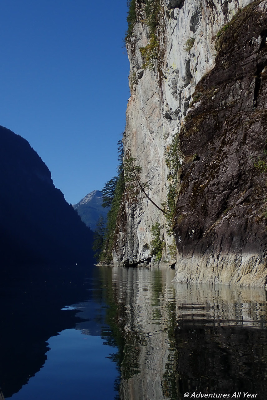
Jervis Inlet is a fjord that reaches about 70 km into the Coast Mountains. It is, just as other inlets lining this coast, a remnant of the last Ice Age. The U-shaped valley and steep granite peaks on both sides are what remains today as well as a deep fjord, waterfalls, and insanely pristine waters.
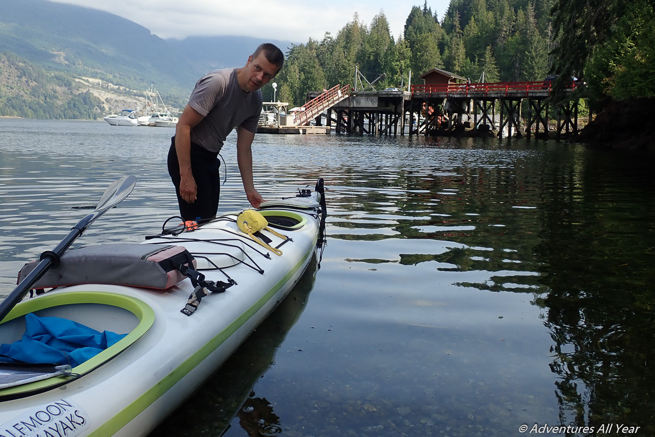
Launching from Egmont
The launching point for this trip is in the township of Egmont on the Sunshine Coast and two ferry rides from Vancouver away. The government wharf and “park as you please” policy makes this a very friendly place.
Of note also is that Egmont is THE spot for viewing one of the fastest moving tidal currents in the world. If you want to see what a 16-knot current looks like, take the 45-minute hike to the Skookumchuck Rapids (a.k.a. Sechelt Rapids) viewing area. Time it in such way that you are there when the maximum flood (or ebb) goes over 10 knots. Consult Tide Tables for when that occurs. Don’t do it in a kayak 🙂
We were saving a visit to the Skook for the end of our trip. For now, our kayak fully loaded and on water, we are turning west from Egmont and heading for Jervis Inlet.
Leaving the mouth of Sechelt Inlet and turning north we are immediately greeted by impressive views of Mt. Churchil and Mt. Spencer, peaks with 1,500m prominence above water. There is an occasional small motor boat traffic but otherwise we have this place to ourselves.
Prince of Wales Reach
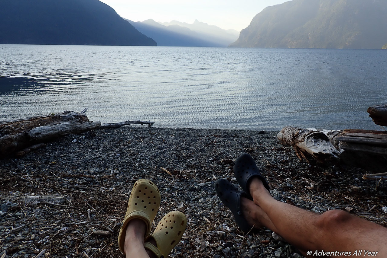
We launched from Egmont around 1 pm so after short 4 hrs of paddling we are on a lookout for a place to camp. We eyed a couple of places along the way and while they were more than adequate we decided to keep paddling until we were both in agreement. Just before Perketts Creek, on the east side of the inlet, our jaws dropped – we found the PERFECT pebble beach, with a million dollar view. It is one of the top ten campsites of my life.
Princess Royal Reach
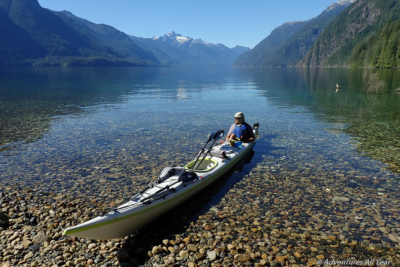
Jervis Inlet is divided roughly into 3 sections, each one day’s paddle long: Prince of Wales, Princess Royal and Queens Reach. Therefore the trip out and back takes about 6 days. Seven if you want to make a stop at Princess Louisa Inlet (and you should).
We had 8 days in total available for this trip and some gorgeous weather – 8 days of sunshine and not a ripple except for one windy day. This was an unbelievable weather fluke as these long inlets are known for ferocious katabatic winds that gather strength in the mountains and then funnel through the inlet at 35 knots. Beware of the katabatic winds, they can literally make it dangerous or impossible to paddle.
Camping
On day two we wave good-bye to our beautiful camping spot and paddle on, wandering into bays, crossing to the other side of the inlet, checking out all the potential campsites along the way. There are not too many but those that are available are absolutely primo. Look mostly at creek mouths but avoid camping at grasslands at the mouths of major rivers such as Vancouver River, Britain River and especially Skwakwa River at the head of the inlet. The grizzly population here is numerous and healthy and these are their prime feeding habitats in spring and later in summer during salmon runs.
Past Vancouver Bay and before Glacier Creek most campsites are on the west side of the inlet as the east side is just one massive, solid, granitic bluff. The best campsites that we identified were at our “million dollar view” spot, the one at McMurray Bay and at the mouth of Crabapple Creek.
Katabatic winds
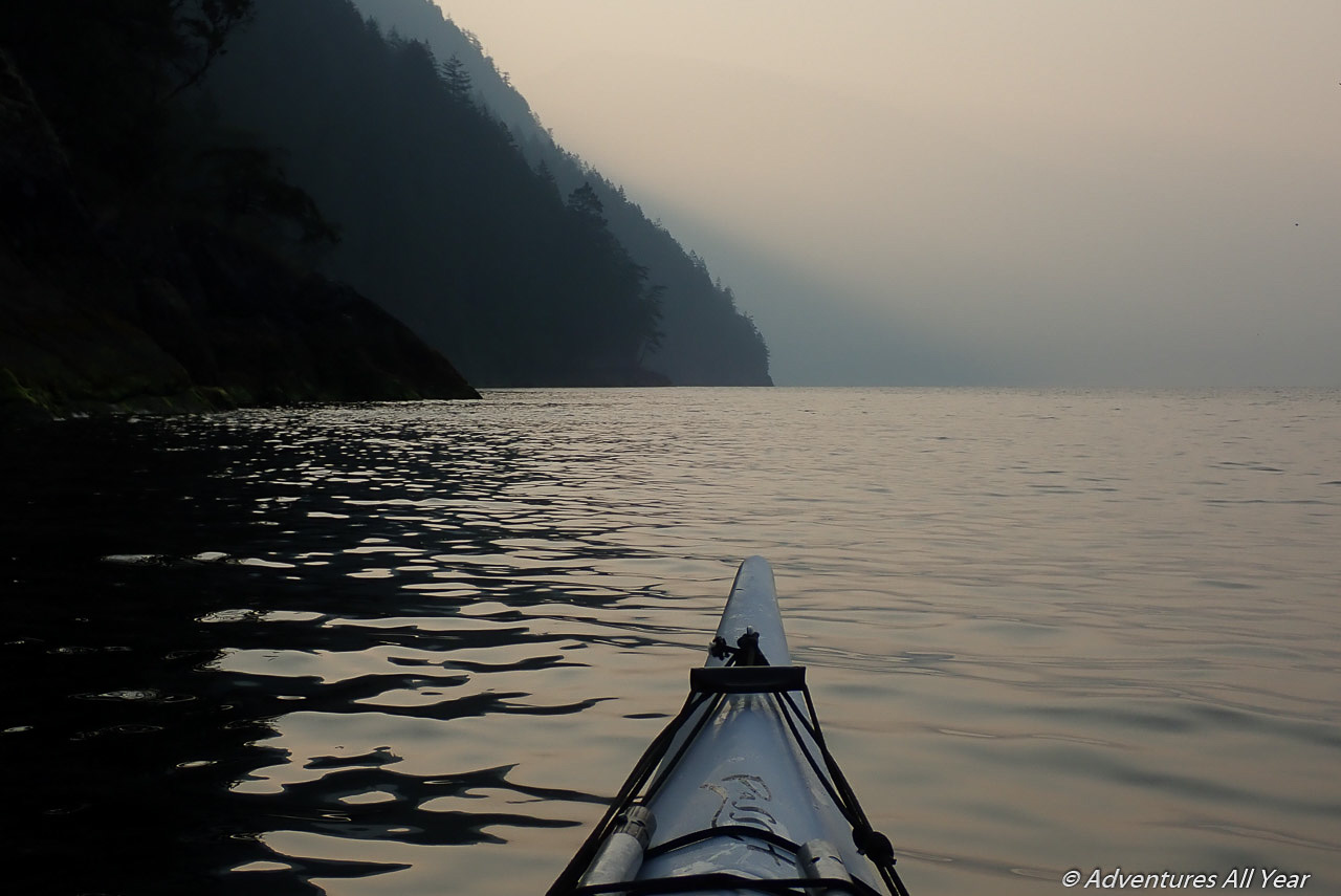
On Day 3 of our trip, as we were getting ready to leave our camp, I noticed whitecaps in the middle of the inlet. I didn’t make much of it as we had paddled in some good wind before and double kayaks are quite stable in rough water. I did not know that we are about to make a stupid decision of paddling into katabatic wind.
As soon as we left the protection of our bay, the waves started ramming our boat. We had to adjust the course slightly so that not be broadsided which meant we no longer could go the shortest distance across. The waves were lifting the bow of our 22′ kayak good 1m up and then crashing across the deck and washing me with buckets of water. I was literally being drenched and Peter, at stern, was faring only slightly better.
The wind was gusting at 35 knots and when a gust caught on my paddle blade I had hard time keeping hold of it, the wind was just trying to rip it out of my hands, vibrating it violently.
The progress was slow and it seemed like we were never going to reach the other shore. There were no other boats around and I was playing a scenario in my head of what to do first in case we capsize. It was a pretty dire situation, actually, but you are so focused on staying upright and on course that you don’t even have much time to be scared. Just an intense focus.
Princess Louisa Inlet
Little by little we eventually made it to the other side and had to pull out on a tiny rough beach to collect ourselves before continuing. We then hugged the western shore closely for some protection from this crazy wind. Our plan for the day was to make it Princess Louisa Inlet, if we could.
Princess Louisa Inlet is a magical place, for me at least. It’s really tucked in there, two-thirds up Jervis Inlet, a little appendix of an inlet so well hidden from view in that if you didn’t have an aerial image you wouldn’t even know it’s there. It’s protected by Malibu Rapids, another fast-flowing channel that needs to be navigated to reach Princess Louisa.
Malibu Rapids
The currents at Malibu rapids are so significant that they have their own current table (it’s a secondary station with reference station being Point Atkinson). You will need to wait for slack to be able to pass, just like other boat traffic that gathers at the mouth waiting for the current to cease and change direction. We arrived about 45 minutes too early and the current was still too strong for us to paddle into it.
Having the time to kill we pulled over at a very pleasant beach but the Malibu Resort – a fantastic retreat with luxurious log houses and other facilities. This being the Covid year, the camp was deserted except for the caretaker who was super kind to give us a little tour of the premises. A fantastic place, meticulously upkept.
Chatterbox Falls
Once through the Malibu Rapids we have reached Princess Louisa Inlet. The granite walls around you close in and all you see is just verticals and the emerald blue waters of the inlet. The summits of those peaks, those you can’t see but through the entire inlet the gurgle of Chatterbox Falls reverberates. They are iconic of Princess Louisa Inlet and I feel a great deal of accomplishment having made it here.
MacDonald Island campsite
Having kayaked on this coast for 8 years I have developed a reverence for B.C. marine parks. Without fail, they are some of the most beautiful places on the coast and I am deeply grateful to BC Parks and the people who had vision to protect these places from private hands and for the public use / conservation.
The major campsite at Princess Louisa is at the head of the inlet but my advice is – skip it. Camp just 3 km before that, but still within the inlet, on McDonald Island. This marine park site is perfect – beautiful shell beach for landing, a floating dock, viewing bluff, private lagoon with crystal clear water and camping under an apple tree.

Trapper’s Falls and Loquils Lake
I first discovered the existence of Princess Louisa Inlet a few years ago by trekking here overland. I use the term “trekking” a bit haphazardly here. It was more of a mountaineering expedition, involving glaciers and all to get here from Squamish. But once we crossed the divide and I got a first glimpse of Prince Louisa far, far below, it was love at first sight. Therefore I knew that from the shores of the inlet a very steep trail exists that will take you, in no time, to the alpine. And I say, if you make it to the inlet – do take a day to hike up to the alpine, Loquils Lake being your destination. It’s at least as stunning up there as it is at the water level.
If you only have a couple of hours to spare then head up the same trail until you reach a dilapidated log cabin (the forest might have claimed it fully by now) located by a very photogenic waterfall. You can enter the creek bed and literally touch the falls. It’s a very soothing place to linger and the hike there should only take about an hour or less.

Retracing the steps.
After a day and two nights at Princess Louisa inlet we had to head back. Carefully picking time for the crossing of Malibu Rapids we retraced our “steps” and checked out all those shores of Jervis Inlet that we didn’t touch before. Even after 6 days spent paddling here I still couldn’t get over the fact that we were the only kayakers here in this paradise.

On our way back we had zero wind and were able to do some long days of paddling, covering over 35km in a day, all with a goal of making some good time for a quick visit to Hotham Sound.
Hotham Sound
I am a provincial parks hunter. Haha, I have to explain that – I have a personal goal of visiting every single provincial park (land based as well as marine) in the southwestern B.C. I’m doing pretty good so far (see this page) that but there are still a few that are not as easy to reach.
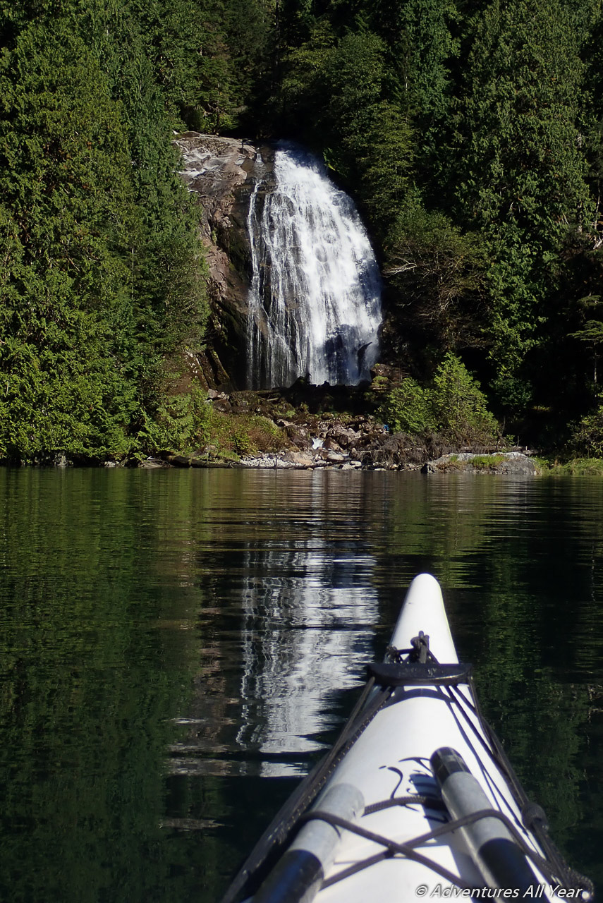
So having an opportunity to check Harmony Islands Marine Park off that list, I couldn’t pass up. Therefore we had to do this “little” 20 km detour up Hotham Sound but it was all worth it: we saw a 400m tall Freil waterfall, a large Canadian Coast Guard ship, ate fresh oysters and had a beautiful, beautiful campsite all to ourselves, again.
It was truly an amazing trip.


This sounds like an amazing trip! There is seriously nothing better than camping alone on a beach in a fjord. I’ve only done it once but it’s on my list for this summer!
Fun fact: in the beginning, my husband used to dislike kayaking, a LOT. He was of an opinion that the sport is “too sedentary “ (:-)))) ). Four years of exploring and camping at some pretty amazing places along the BC coast and he’s a complete convert.
My good friend and I decided to go and actually do this last summer (July 2024) and let me tell you this trip is not for the faint of heart. I first learned about this place the summer before after doing some day kayaking around the area with my family.
In skiing terms, this trip is double black diamond, and we were green circle kayakers. We were fine on the camping side as I am a backpacking guide, but not ok on the kayaking side. Anywho- this next tidbit might seem super obvious to a seasoned kayaker, but was not obvious to us. The tides are super duper important – like essential you can die. This article doesn’t super mention that (like I said obvious to a seasoned kayaker not obvious to noobs like us). You gotta follow them even if that means you are waking up at 3am (like we learned we had to do). We were not able to paddle between 11am and 7pm. Also the inlet takes about one hour to cross from side to side. We got into a really sticky situation before the bad section described in the article and we were beached for 6 hours on a cliff about a 30 minute paddle away from the campsite. We turned away after arriving to McMurray Bay because we truly had no idea what the heck was going on and we can close to death kayaking one too many times. Also – we highly recommend bringing a marine radio, it could have saved our life if needed but I only had an InReach.
That to be said – if you are a seasoned seawater kayaker, this trip is truly stunning and we had the entire place to ourselves.
Anywho- I appreciate the advice this article gives, but just know this trip is about 20x harder than the article makes it seem. If you looking for an alternative, Lake Powell on the north coast would be awesome (what we should have done) and that is what I recommend novices do (like ourselves).
I appreciate your comments, I really do. As you said, they give a perspective of someone who may be new to kayaking. I must add that when we go kayaking, not just at Jervis but literally anytime we go kayaking, we are playing it SUPER safe – reading tide charts religiously, crossing narrows at perfect slack (you make that mistake only once, hehe), listening to wind forecast and planning our paddling times around it. Yes, many times that means we are waking up at 5am or earlier. That’s simply the name of the game, if you truly want to enjoy kayaking and not white-knuckle it. Most kayakers I know plan their trips carefully around all of that. Having said that, if you stick with it and do more kayaking trips, I promise you, the long crossing will start feeling shorter and big waves will look smaller, just as when you look at a black diamond ski run and realize you got this.
We did this trip as well a few years ago. We wanted to do a key swap kayaking/mountaineering multisport trip with a couple of friends who were starting in Sim’s Creek and planned to cross via Mt. John Clarke, but they unfortunately didn’t make it, so we just had a nice week of paddling and lounging. Those winds are no joke though: we had strong inflows whenever the sun was shining, and they were so bad on one of our egress days that we ended up sitting on a crappy beach for four hours across Jervis from Malibu Rapids until it calmed down enough to head out.