Kayaking and camping adventure near Vancouver
We often think of trails as a defined path on a forest floor but waters have their well-trodden routes as well. Just like a forest trail follows a logical path of least resistance, a waterway links safe harbours to best fishing spots, sources of fresh water and campsites protected from prevailing winds.
Howe Sound boasts one of such marine trails. Sometimes referred to as Sea to Sky Marine Trail it is an an important extension of the Great Trail (Trans-Canada Trail, TCT). The trail is also a great local kayaking destination if you want to get away from the Mount Seymour hiking crowd.
The organization that carries on protecting the marine sites and ensuring a modern day seafarer has a place to camp on the B.C. coast is BC Marine Trails. Their online map showing traditional marine routes and potential campsites has been invaluable in planning my own kayak trips up the coast. Please consider to donate even a small amount. I am in no way associated with the organization but I think that the work they are doing is fantastic, important and needs to be supported.
The usual kayaking precautions apply: Howe Sound is subject to some strong northerly outflow winds and the southern portion around Bowen and Pasley Islands gets affected by winds blowing in the Straight of Georgia. So if you are new to kayaking then go in a group. But above all – check the weather forecast on each day of your expedition and paddle when winds are less than 10 knots (from experience, this is wind speed that will not frazzle novices). The paddling distances are not huge so it’s always better to wait it out.
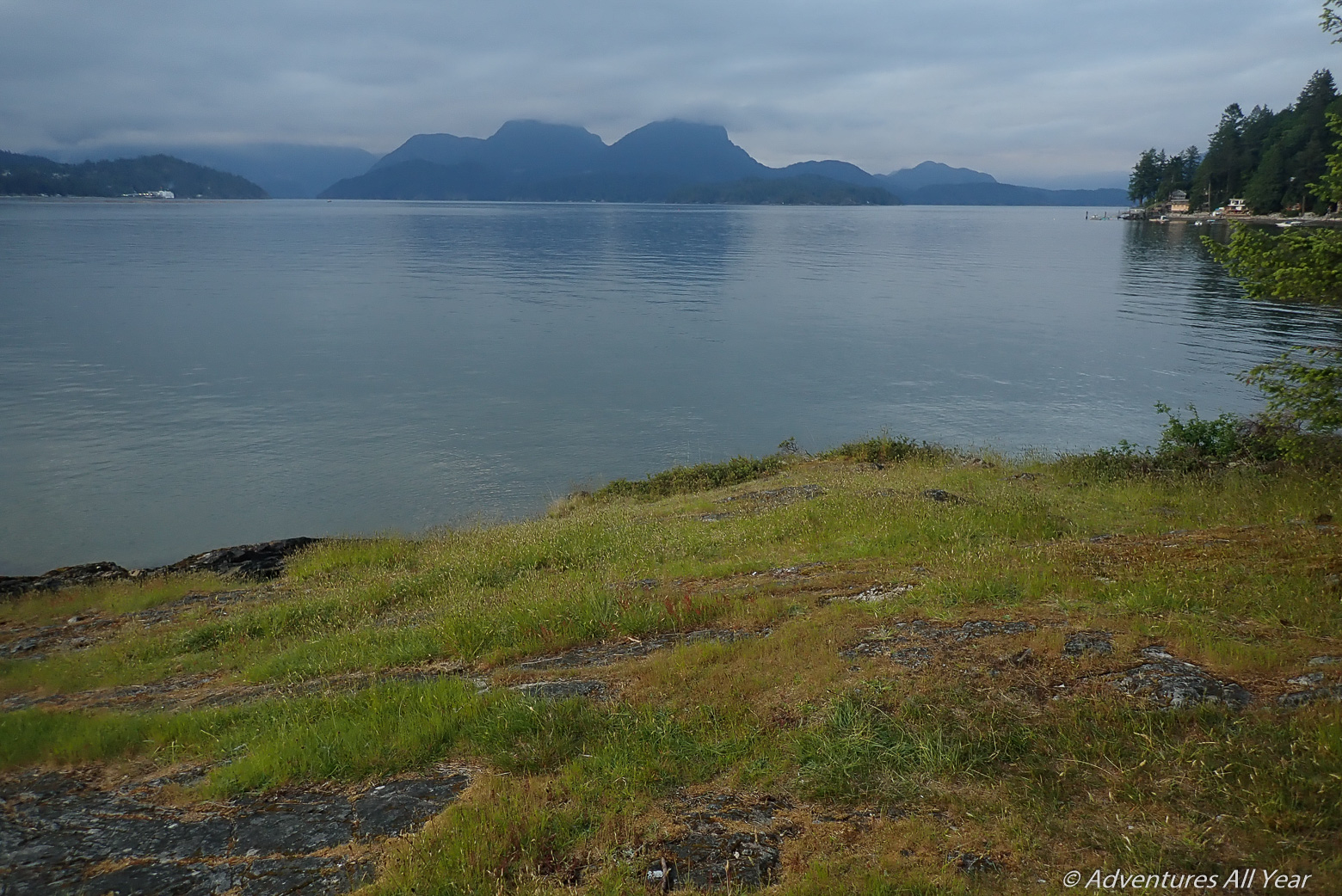
Halkett Bay
We set out on a 4-day trip around the southern portion of Howe Sound on Victoria Day long weekend. The usual four suspects – Magnus, Hana, Peter and I launched kayaks from Lion’s Bay beach (you need a Lion’s Bay parking permit to leave the car overnight) at 5 pm and headed straight for Halkett Bay Provincial Park, some 6 km away. The outflow winds usually quiet down for the evening so we covered this distance in no time gliding over calm water.

Halkett Bay, however, was not calm at all. This being an advent of a long weekend a bunch of other campers had already claimed all the official sites so we had to seek out a spot in the adjacent forest. On a regular weekend Halkett Bay is worth a visit though. The pretty campsites are fringed by giant ferns reminiscent of Hobittown. The campsite provides access to Mount Artaban with the trail starting right from the camp.

The following day we headed south towards Bowen Island. In the shortest distance it is a 2 km crossing from Halkett to Bowen which, in a double kayak, can be covered in about 20 mins. However, the path crosses the Langdale ferry route with poor sightlines. If you are partway through your crossing and a ferry materializes from around a corner you might not have enough time to cross. Best to check a marine application for the position of vessels, I use this app. Or use your VHF radio to check in with the marine traffic control.
Breaking the Rudder
Halfway through the crossing Magnus tells Peter, in his iconic underestimating voice: “Peter, your rudder seems to be off”. And not a full minute later: “Peter, your rudder is about to fall off.” Magnus reached for our rudder and put it in stowage position, out of the water. It seems to have cracked and broken in a clean shear and was holding only by a thread when Magnus saved it from being completely separated.
Well, we saved the rudder but lost control. Crossing the ferry channel the waves are hitting us broadside and Peter and I have great difficulty maneuvering the boat. We need to pull out and assess the damage. My mind is racing, eyes trying to scan the horizon for our best landing spot. We land at a tiny islet just N of Hutt Island, a satellite of Bowen.

The tide is coming in and we need to pull both boats over some rocky ledges as the beach disappears at high water. We grunt but manage to get both boats on higher ground where we discover that the metal rudder has completely sheared off due to metal fatigue or a hit taken on some previous trip. Part of me knows that the trip is over for us. Without a functional rudder we won’t be able to steer the boat in windy conditions. For now, we just set camp as we need to decide what to do.

Hutt Islet
Hutt Islet is charming. It does not show on the BC Marine Trails map as a potential campsite but it has definitely been used as such with wobbly table and benches put together using driftwood. It gave us a safe haven to attempt the rudder repair but I cannot really recommend it as a place to camp – difficult access, no outhouse or a place to “go” and potentially fragile flora. Therefore your next best option this side of Howe Sound is Plumper Cove on Keats Island, a fair distance away.

My husband Peter is amazing. I admit I wasn’t paying attention, in my mind we were heading home the following day when the seas calm down, but somehow over the course of the afternoon he was able to cut off the broken piece of metal, file away the edges, drill a new guy line hole and reinstall the modified rudder back onto the kayak. And all of this using just a Swiss Army knife!
Pasley Islands
We are back in the game. The morning breaks windy and gloomy. We head towards Pasley Islands which, under sunny weather are an awesome group of little islands to explore but on this windy day we just want to get it done and over with. So we head directly for Plumper Cove on Keats.

I have previously written about a kayaking trip to Pasley Islands, see this post. Note that the best time to visit is during low tide when many of the pretty white sand beaches in this area are visible and beckoning. To check tides head HERE, Point Atkinson being your reference station.
Plumper Cove
With the delay due to our unplanned stay at Hutt Island we arrive at Plumper Cove Provincial Park the day after a major weekend crowd and are one of the only two groups staying in the campground that night. The park ranger tells us that the night prior the camp was overflowing and we are somewhat grateful that we didn’t have to contend with that.
With the afternoon still young we head out on foot and wearing the best shoes we have – Crocs – for a short hike to Lookout Peak, a local viewpoint. The view from the summit did not disappoint and on the way back we loop around to the Farm Trail and enjoy our longer return to camp thoroughly (BIG trees). With Covid out of the way you will also be able to visit and buy some homegrown goodies at the Barnabas Family farm.
Thornbrough Channel
On Day 3 we head up Thornbrough Channel, having to cross the ferry route once more but once past Langdale ferry terminal we’re out of sight and into unknown waters. Protected from view by large Gambier Island, this channel rarely sees recreational traffic. Fringed by log dumps and dominated by Port Mellon pulp mill it holds little visual attraction but is nevertheless an interesting place to paddle, if for nothing else then for the mere novelty of it. I have seen Thornbrough Channel from high above before, looking at it from the summit of Mount Eplhinstone, and I must say that the colour of the water is astounding – that turquoise green that only glacier runoff can produce. From the water level, however, we do not see the hue and so just paddle along observing the unknown coast.
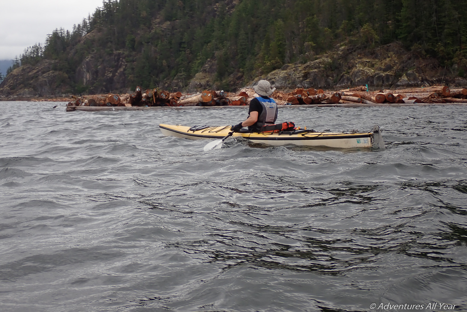
Without any suitable beaches to land we are happy to see two yacht clubs at the northern end of the channel – pontoons, floats, restaurants and all. Who would have thought something like that lives here?
Ramillies Channel
Rounding the N tip of Gambier Island we are back into the familiar waters with Anvil Island coming into sight. There are two possible places to camp along this side of Gambier: a grassy clearing at the mouth of Gambier Creek, a.k.a. Douglas Bay – an attractive, open spot; and at Ramillies Channel provincial recreation site, a maintained site with tight camping spots but a really nice outhouse and a pleasant pebble beach. Lots of beaches along this shore and further south have been historically used by the local first nations for camping and gathering.

Pam’s Rock
As you drive from Squamish back to Vancouver, there is this set of prominent rocks protruding from the water just south of Anvil Island. They have no vegetation and appear to be composed of white granite. I’ve been longingly staring at these rocks every time we were coming down Hwy 99 and today, today is the day that I am actually going to see them up close.
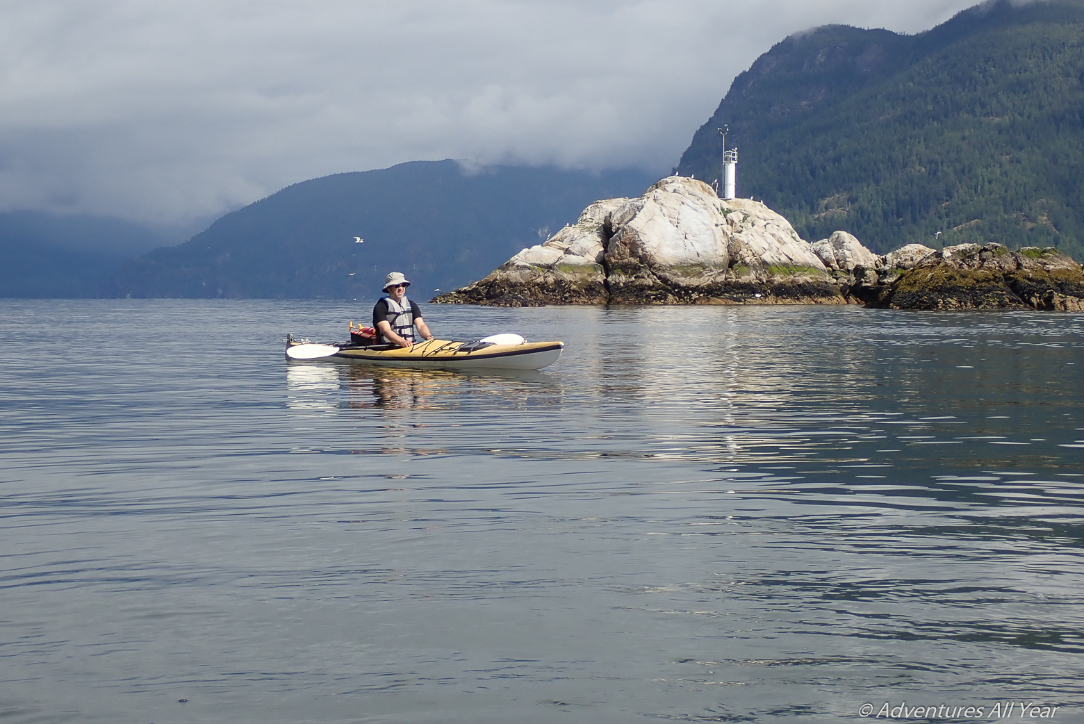
A beautiful sunny morning. Super calm. The water is like glass, unbroken by a single ripple. We glide quietly towards Christie and Pam’s Rocks and the closer we get the louder the shrieking gets.

Christie Islet is a bird sanctuary and you can bet that birds cue into things like that. The entire island, which is almost 300 m in diameter is covered in bird nests and guano. I’m not a birder but I recognized the common seagulls, pidgeon guillemots, cormorants and my favourite – oyster catchers. Although, as my friend Dan points out, “How difficult is it to CATCH oysters??” In addition, low tide exposes additional ledges, perfect for basking seals. Lots of pups around this time of the year that launch themselves in a panicked mass into water as soon as we come from around the corner.

We spend a good time paddling without uttering a word between the nooks and crannies, trying not to needlessly startle the wildlife so that they can, too, enjoy a peaceful Tuesday morning.
In conclusion:
Howe Sound is a lovely, lovely place with many interesting corners than what immediately meets the eye.
I love it on calm, sunny days. Add to it low tide and that’s when I recommend that you head out to explore its many coves and sandy beaches.

are there drinking water sources along the route at the campsites?
Hi – yes, there is water pump with drinking water at the Plumper Cove campground on Keats Island. There is no creek at the Ramilies Channel campsite, there are a few creeks at other places on Gambier Island where we didn’t stay but you’d have to treat the water.