Camping on small islets and whale-spotting
Each year we try to do at least one week-long kayaking trip. Having paddled around Discovery Islands the year prior we wanted to come back to the same area for more – this time the choice was the circumnavigation of Cortes Island, a kayaking journey of 105 km with camping at some very scenic spots and free whale watching included.
Starting Point
There are two options for where to launch for the Cortes Island circumnavigation, depending on your comfort level with larger crossings (~5km):
- If you’re looking for an easier trip, take a ferry to Vancouver Island, Drive to Campbell River, take a ferry to Quathiaski Cove on Quadra Island, drive 10km to the other side of Quadra to take a ferry from Heriot Bay to Whaletown on Cortes Island. Start kayaking from one of the following recommended launch sites on Cortes: Squirrel Cove, Smelt Bay Provincial Park, Manson’s Landing Provincial Park.
- For more paddling, launch from Lund on the Sunshine Cove (serviced by BC Ferries from Vancouver) and paddle over to Savary Island (~2km). From the west tip of Savary head for Hernando Island, 4 km away – watch for currents in the channel between the two to make sure they don’t work against your efforts :-). Paddle to the N tip of Hernando and cross over to Twin Islands. This should be a good day of paddling. Stay on Twin Islands overnight.
Map and Itinerary
The drillable map below shows our itinerary and the campsites that I would recommend. We didn’t stay in all of them, naturally, but I make a habit of scouting all potential campsites along the way for future trips and they’re highlighted on the map 😉
Clockwise or Counter-clockwise?
It does not matter which direction around Cortes you go. Before the trip we kept checking our favourite weather app for wind and decided to go clockwise as it offered most protection on those windy days.
One of the main considerations was getting safely around the southern tip of Cortes Island, a.k.a. Sutil Point, which is known for shallow waters stretching quite far out south and sprinkled with some huge, barely submerged boulders – we needed calm water to negotiate between those. If you’re not lucky for a calm day during your transit through the area you’ll just need to paddle further out to clear the shallows. A marine marker with a bell out to the south shows where the safety of deep water is.
Sea state and Conditions
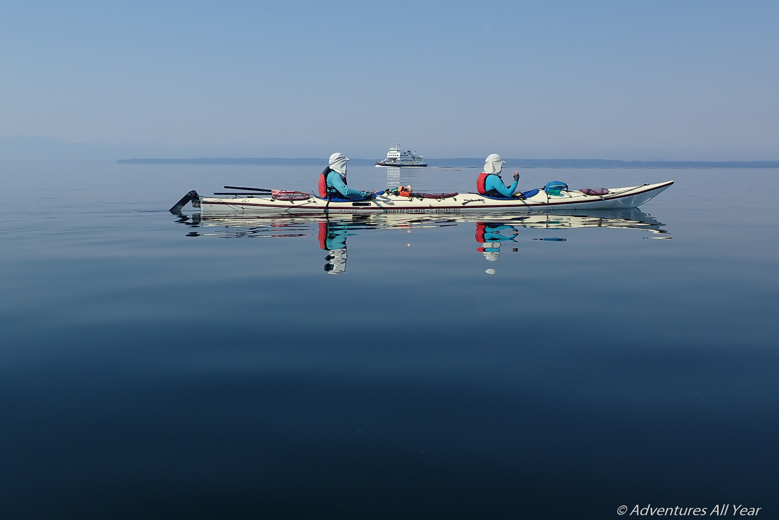
During our week on Cortes the entire B.C. South Coast was under a heat dome so if I have to choose whether to spend 40 degrees in the city or on the water I choose to be in a kayak. The positive side effect of such heat domes – if that is something that is to repeat year after year – is that they offer ideal conditions for kayaking. There was literally not a ripple on the water for days, see the picture below. And that was not just around Cortes. We had the same report from our friends who, at that time, were kayaking around Cape Caution, one of the most notorious and feared spot higher on the coast known for big swells and crashing waves.
Towards the end of the week we did get some good wind though. The prevailing summer winds in this area are westerlies and this was most felt in Lewis Channel which is narrow so tends to accelerate winds even more.
For the circumnavigation of Cortes the key points to pass in favourable conditions are Sutil Point at the S tip of Cortes (see my description under “Clockwise or Counter-clockwise?” paragraph above), then Bullock Bluff on the NW tip of Cortes and then passing through the Lewis channel.
The tides are quite strong in this area and it was evident in many places – landing at Twin Islands, clearing Shark Spit, getting in between Penn Islands but also in the main channel between Penns and Cortes which is 3 km wide.
At the time of our trip the tidal currents were peaking in terms of their monthly cycles. They were not impossible to navigate but you definitely saw the water moving at a fast clip and we needed to be intentional about timing of crossings and departures.
A useful tip (not evident from the chart): the flood tide in Lewis Channel flows from N to S 🙂 We needed this key information to time our passage but the chart does not show directional arrow for that channel. Interestingly, the flood in Desolation Sound & Teakerne Arm sets in the opposite direction.
Where to camp?
Several very good camping options were encountered on this trip. I will highlight those that I thought were top choices:
Twin Islands (50.042905, -124.947445)
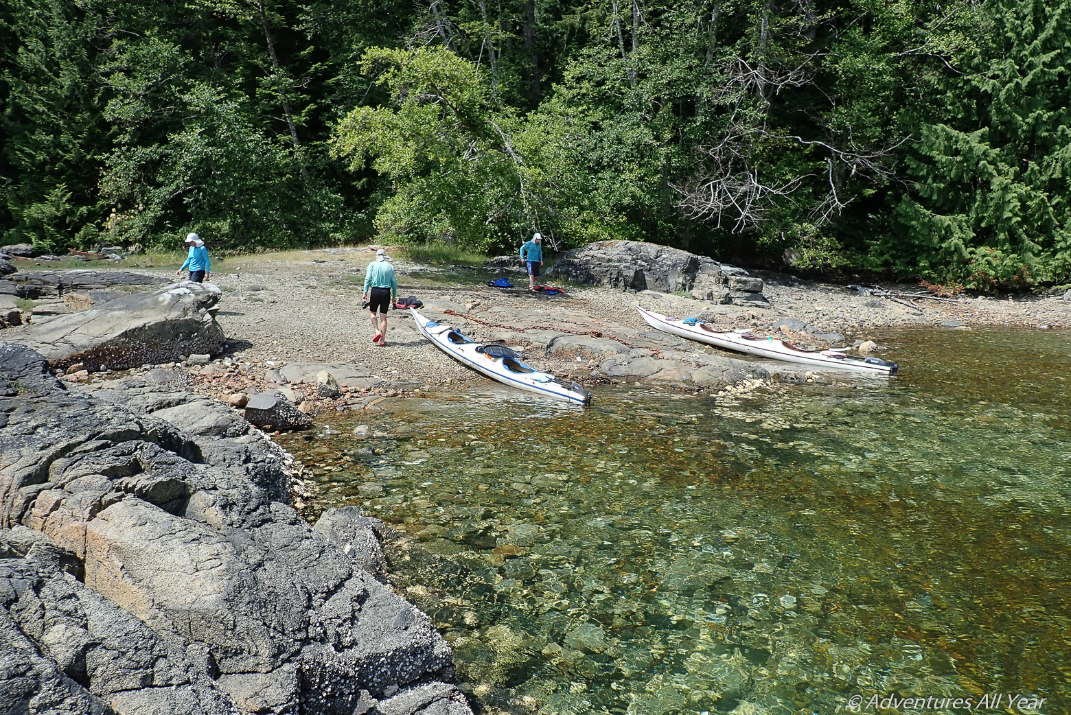
The campsite itself is at 50.042905, -124.947445. It was not easy to find a good landing spot as both options (the cove to the immediate north or rocky shelves to the south) require a difficult boat carry to clear the high tide mark. But in the absence of other camping sites nearby this site has a good strategic location for breaking up your trip. Added bonus: it has lovely swimming rocks to lounge on until sunset.
Smelt Bay Provincial Park (50.031265, -124.995725)
Absolutely beautiful, long, fine gravel beach to land on. Provincially-maintained campground. Will have other visitors but the overflow area closest to the beach has open level grassy sites for unplanned arrivals and a drinking water tap. The disadvantage is a 100m gear carry from the beach to the tent sites.
Shark Spit on Marina Island (50.08764, -125.04529)
Given that this unofficial, unregulated and free campsite is located on a privately-owned island but is tolerated and has some facilities including a pit toilet – this is absolutely generous from the landowners and I beg you to keep the site clean and orderly not to compromise that privilege for future campers.
The location itself – on a long, narrow strip of sand and fine shells – is worth a stopover. At low tide, the sand banks drain extensively and will require up to 300m gear carry but will also bare a long spit to walk on. The N side of the spit overlooks towards Rebecca Spit on Quadra Island and is a favourite hangout place for humpback whales.
Carrington Bay (50.135134, -125.003010)
The spacious campsite on the neck of the land between the Bay and the lagoon is a lovely open place to camp. A neat nearby feature is that during the change of tides the lagoon drains at fast pace creating a river of water rushing into the bay. You can watch this safely from the little bridge built over the narrowest point.
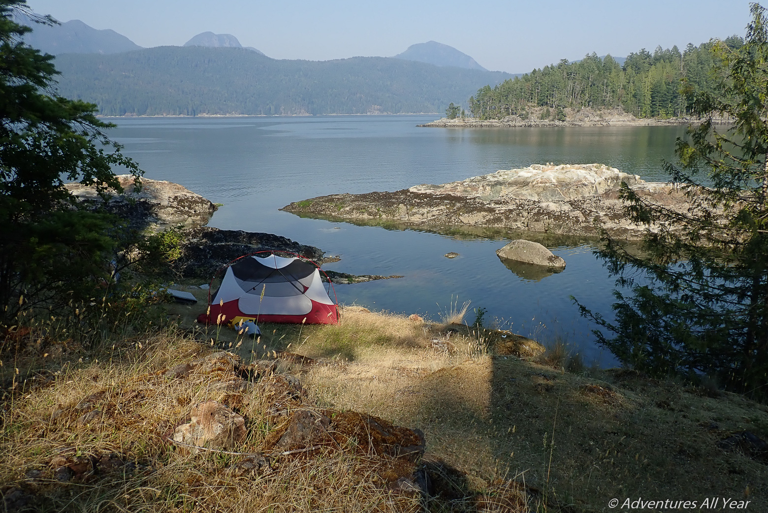
Penn Islands (50.197531, -125.024219)
An absolute star in this lineup, the grassy headland over an attractive small cove with good landing holds a few level sites for about 3-4 tents. Not only it is a pretty site, it is also overlooking a channel appropriately called Whale Passage 🙂 We had daily (and nightly) humpback visitors. Sometimes you heard blows in the distance but sometimes they passed just 100m from the campsite.
Rendezvous Islands (50.256309, -125.033194)
A little further N from Penn Islands is another pretty site. Some kayaking guides suggest that there is more than one suitable site on the Rendezvous but I found this one is the easiest to get to: 50.256309, -125.033194. Very pretty, open grassy site, nice protected cove filled with oyster beds. We visited on a previous trip but is an option for those circumnavigating Cortes.

Lewis Channel (50.209916, -124.948592)
I am listing this campsite here as it is grassy, pretty and comfortable but potentially windy as the entire Lewis Channel can be. However, if you have to camp in Lewis Channel, this is the best place to be.
Teakerne Arm (50.197909, -124.853728)
A primo site on bald rocks with a pretty shallow cove to land on and pristine green waters to swim in. A good location for oyster picking too. A nearby attraction is a float dock that marks the start of a trail leading to a beautiful freshwater lake (Cassells Lake) – about a 15 min hike. Note that the dock might be tricky to land at and disembark from a kayak. It is also busy with dinghies from the sailboats that love to anchor in this bay.
Other attractions
Lakes! Freshwater lakes to swim in. A short hike from the beach gets you to some gorgeous freshwater lakes to swim in. Top three:
Hague Lake
Pull out at Manson’s Landing beach and follow a footpath along the S shore of the (stinky) lagoon to a road, cross the Sutil Road, follow this road for a very short distance and then down to a white sand beach at Hague Lake.
Robertson Lake
Pull out at the following beach: 50.193609, -124.976187 and look carefully behind the washed out logs at the high water mark for a trail into the forest. The entry is not obvious to see from the beach but once you find it the path is obvious and easy to follow. It’s about a 20 minute hike to Robertson Lake. keep hiking along it until you see an area that is not clogged with floating trees.
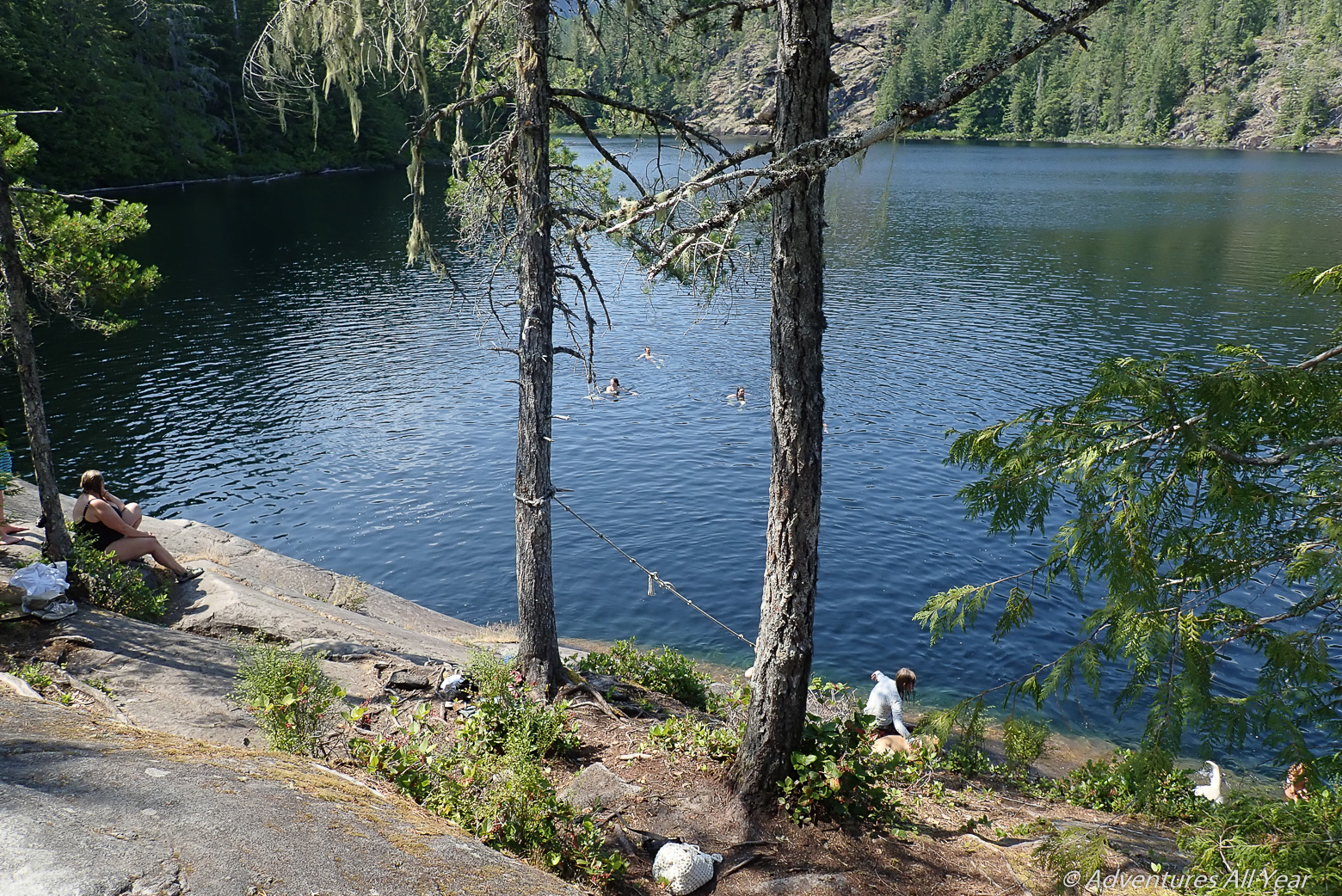
Cassells Lake
Starting point is the provincial park floating dock in Teakerne Arm. The hike is short (10-15 mins) but the lake itself is guarded by smooth granite slabs around it. Rope swings have been put in place or you can carefully shuffle your way down one of the slabs on your bum. The landing is safe in water 🙂 The lake and the water is pristine.
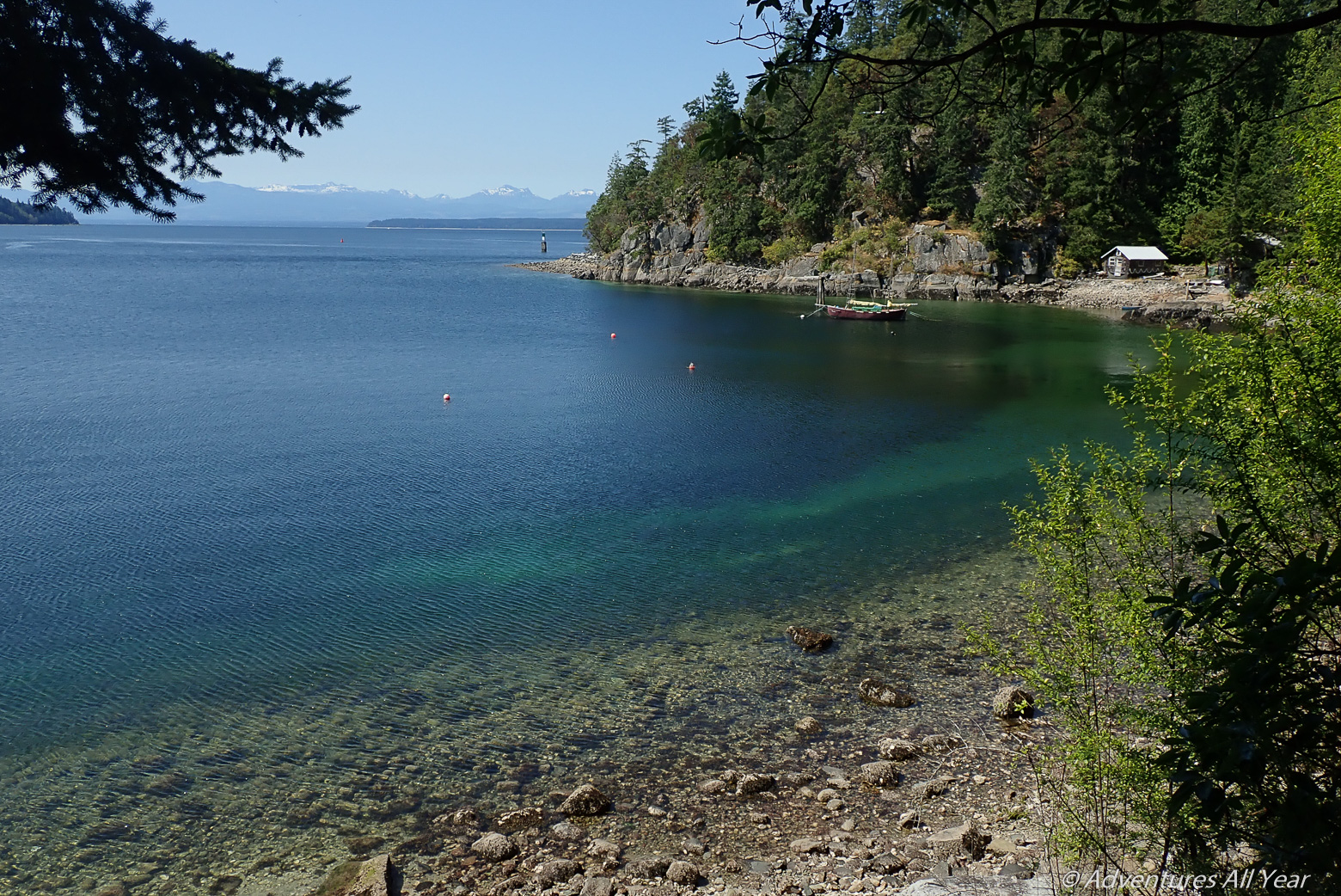
Whaletown
Whaletown is the buzzing centre of the island. It has a nice beach park adjacent to the ferry dock with beautiful emerald green waters. Watch for the arriving and departing ferries.
Gorge Harbour Saturday Market
If you happen to be around Gorge Harbor on the day of the market do not let this opportunity pass without visiting it. We have verified reports that it is absolutely worth the visit, especially the baked goods 🙂

Great article and very helpful to plan my trip! Thank you! Jan (CZ)
Thanks so much!
Thank you for this detailed trip report – we are investigating a trip along the western side of Cortes up to South Rendezvous Island and your notes have been very helpful!
So glad to hear that – an amazing area for paddling. Have been going back to the Discovery Islands over and over again!