This was a difficult trip, even though we have done several long (10 days or more) ski traverses on the coast before. It will test your experience with camping and survival in winter conditions, navigation over gnarly terrain, and your degree of confidence traveling through unfamiliar and potentially dangerous landscapes.
The description that follows is the account of our daily events and hurdles. It might get too technical at some points but the intention was to write it up for anyone who’d like to venture out in that direction and is looking for some “beta” (information about the area, in the mountaineering jargon).
April 15 to 26, 2017
Start: Upper Lillooet FSR km 45.5 (Salal Creek FSR)
Finish: Upper Lillooet FSR km 49 (Keyhole Bridge/ Upper Lillooet IPP intake)
Day 1: Lillooet FSR to Salal Creek N branch
(April 15, 2017; Distance: 9.1km; Elevation Gain: 538m; Weather: overcast/sunny)
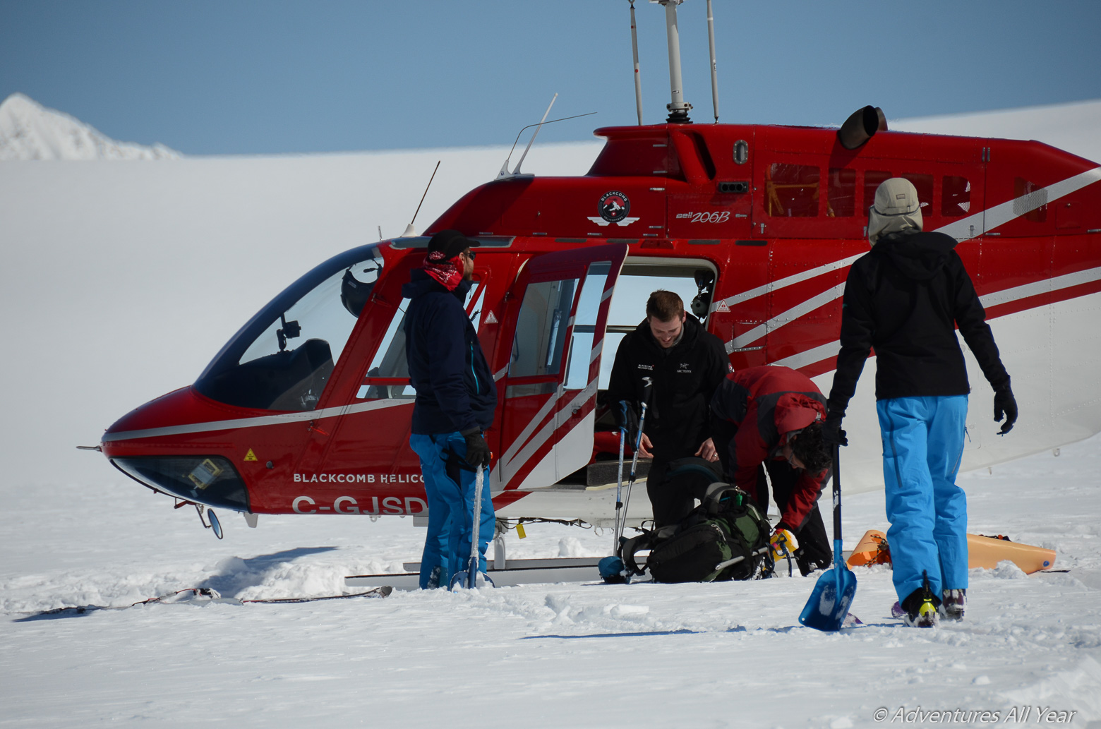
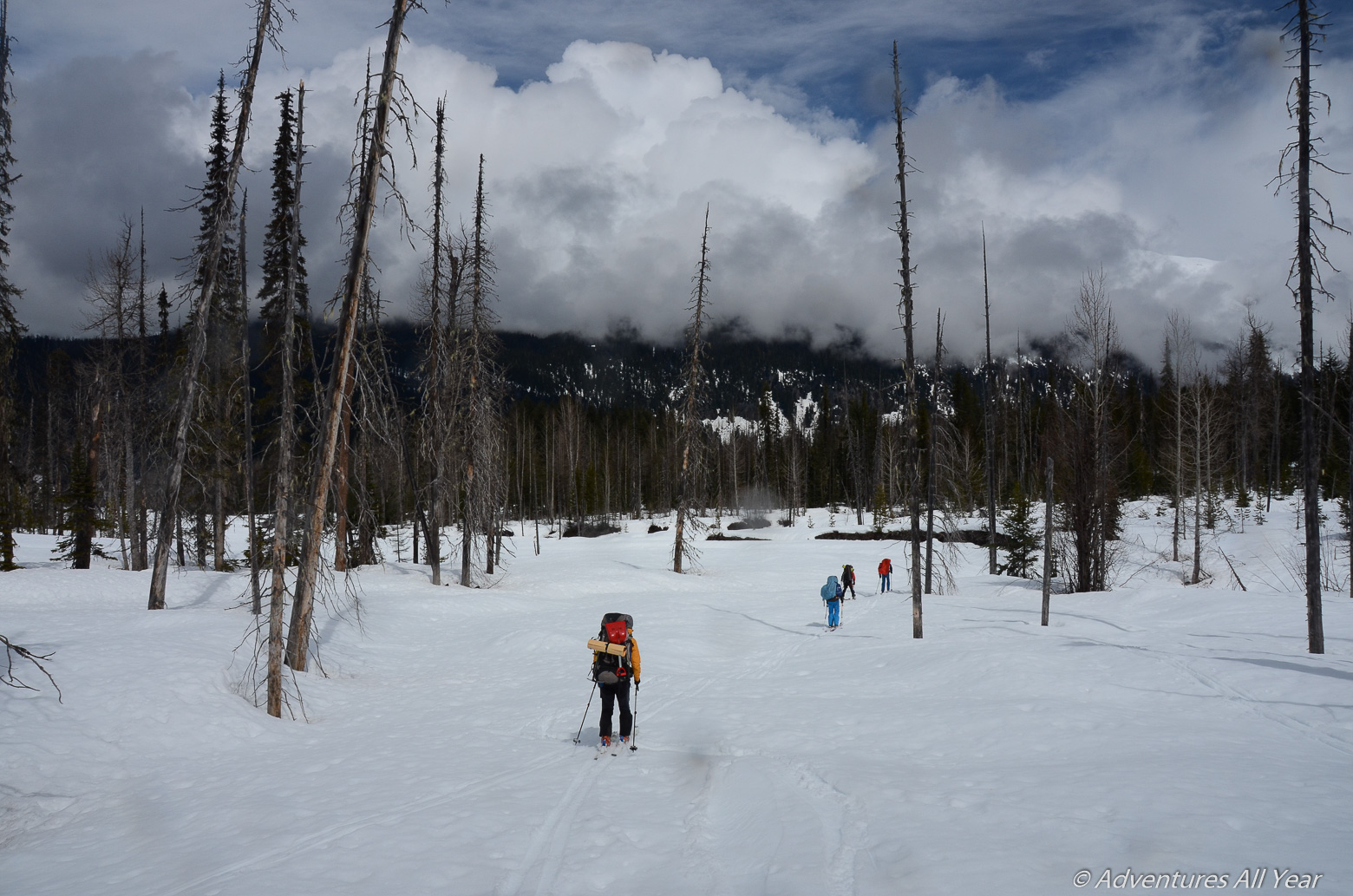
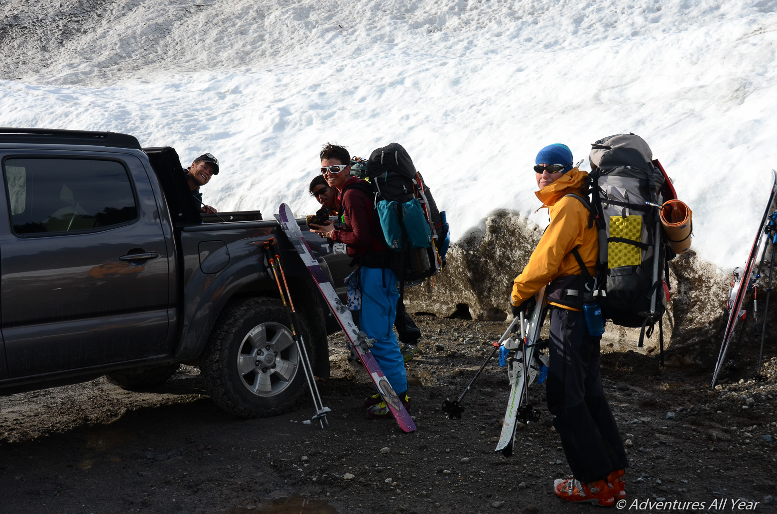
The adventure begins on the morning of Peter’s birthday. This information is completely irrelevant to the trip outcomes, I just thought I’d mention the 3-pound strawberry cheesecake that I secretly carried in my backpack for 20 km. On the morning of, however, our crew of six is waiting out the weather in a coffee shop in Pemberton. While it rains, we shamelessly stuff our faces with plate-sized cinnamon buns and drinks high in sugar content. Around 9am the weather finally decides towards sunshine so we’re out of the door and driving towards Lillooet forest service road. At km 45.5 thereof we stop to unload gear and to do a short car shuttle to km 49, our end point if all goes well. After all this kerfuffle we’re finally off into the wild.
That night we camp on the flats where the W and N branch of Salal Creek meet.
Day 2: Salal Creek W Branch to White Cross Ridge
(April 16, 2017; Distance: 12km; Elevation Gain: 1,229m; Weather: sunny, clouds moving in in evening)
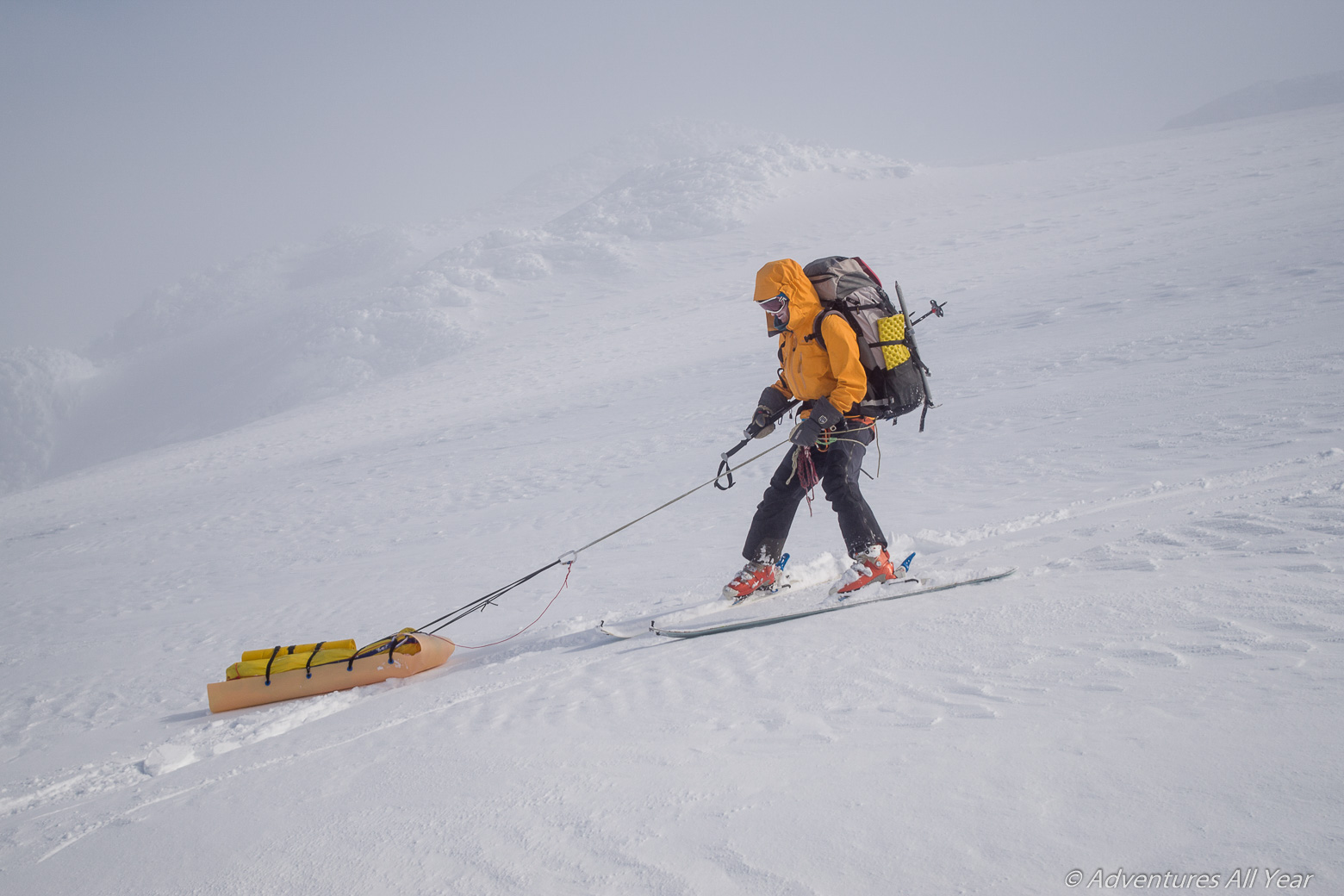
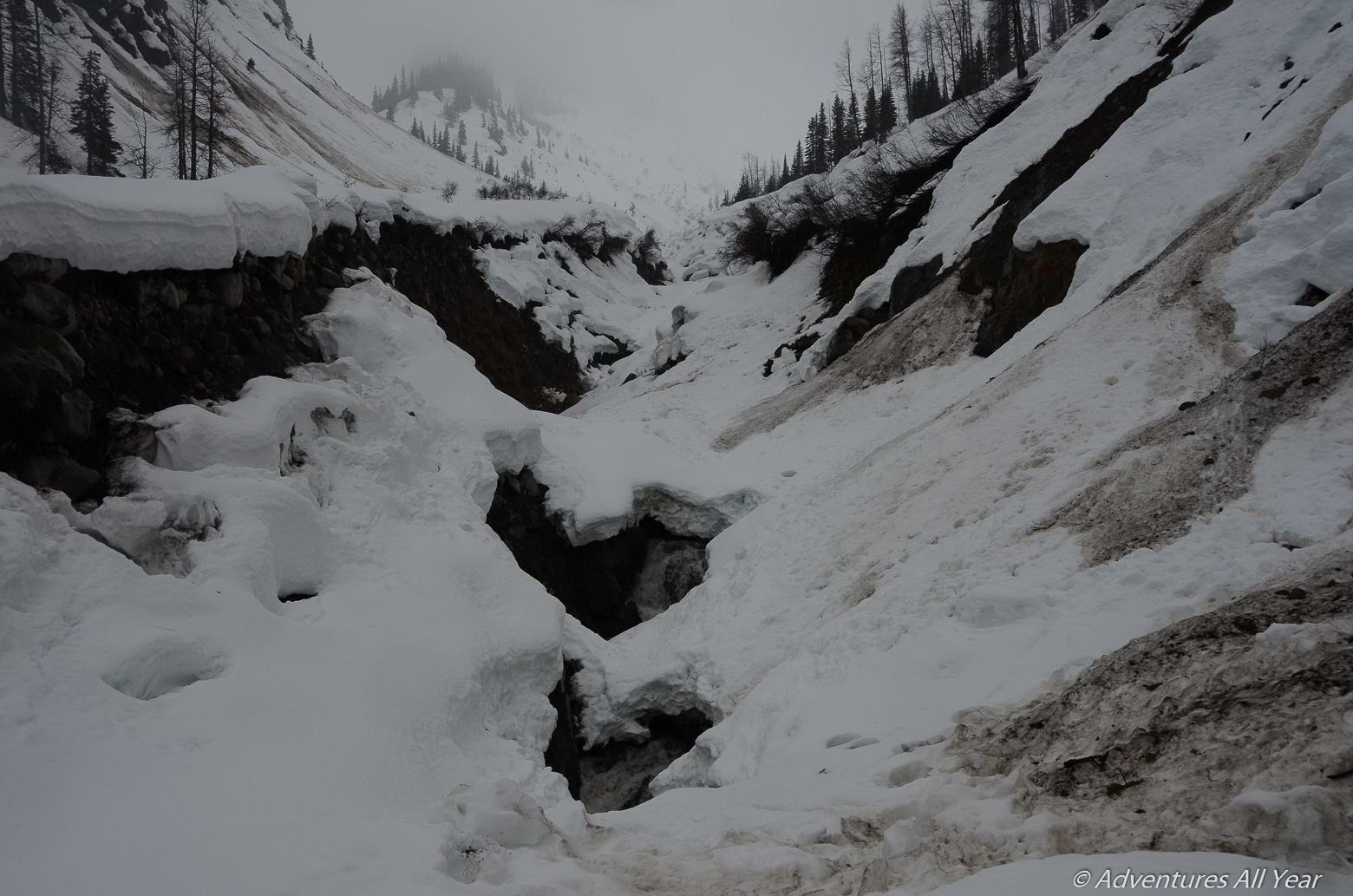
A 4:30am wake-up call is met with some poorly masked discontent and audible growling. However, we all know we need to get going in order to clear the W Salal Creek canyon before it warms up too much. It is a good terrain trap with steep walls around it. As we pass through the canyon around 11am the snow starts to soften up and sluffs from the sides. A party from 2014 recommends this canyon as the preferred way out (or in) but be warned that the canyon is tight with not much room for maneuvering and no escape route. Once you’re in, you’re in. The convenience of this route also much depends on the snow level. At the time we were there (mid-April) the creek cover already had 2-3m deep gaping holes with running water at the bottom. Our sleds LOVED checking those out.
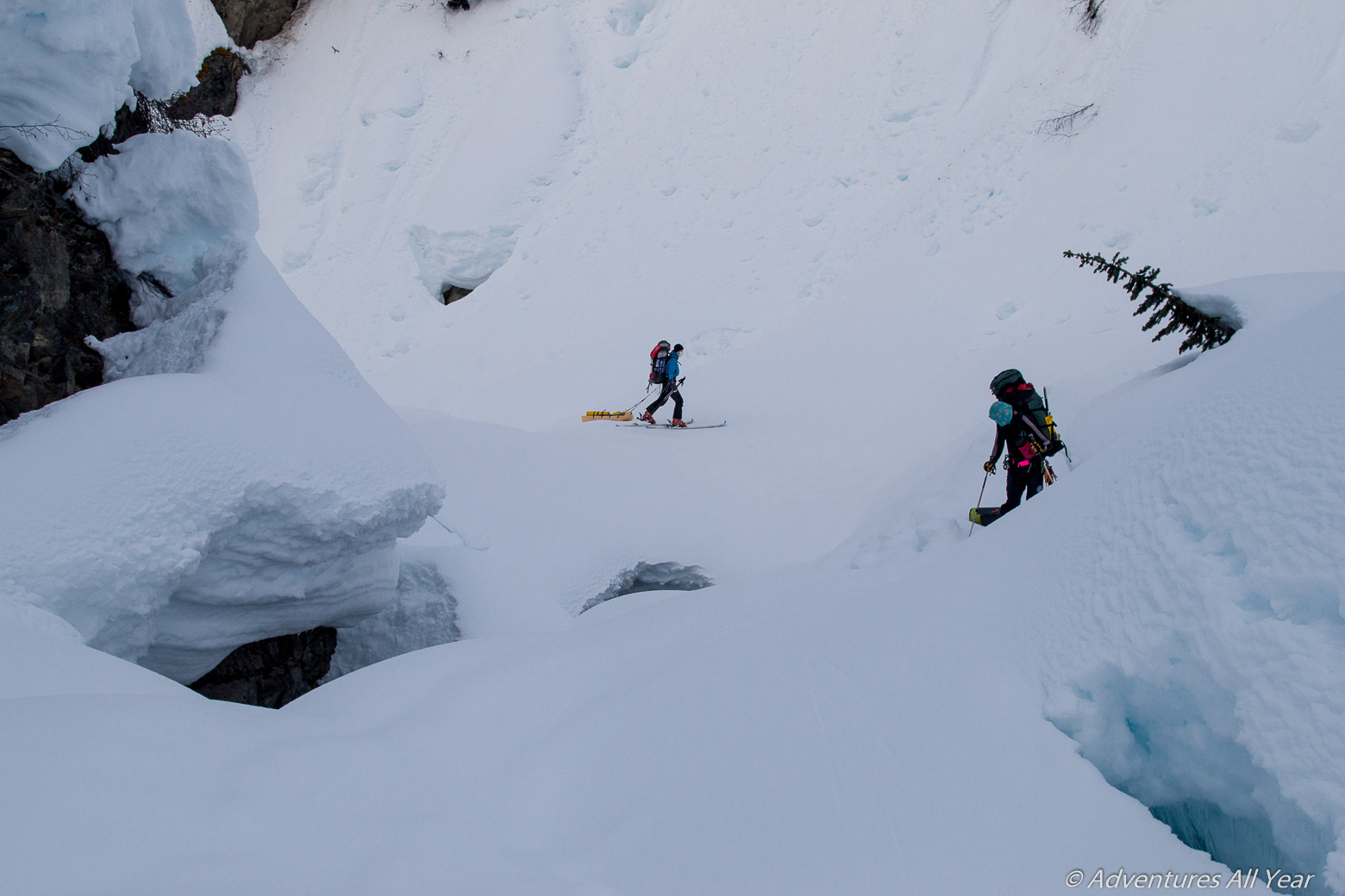
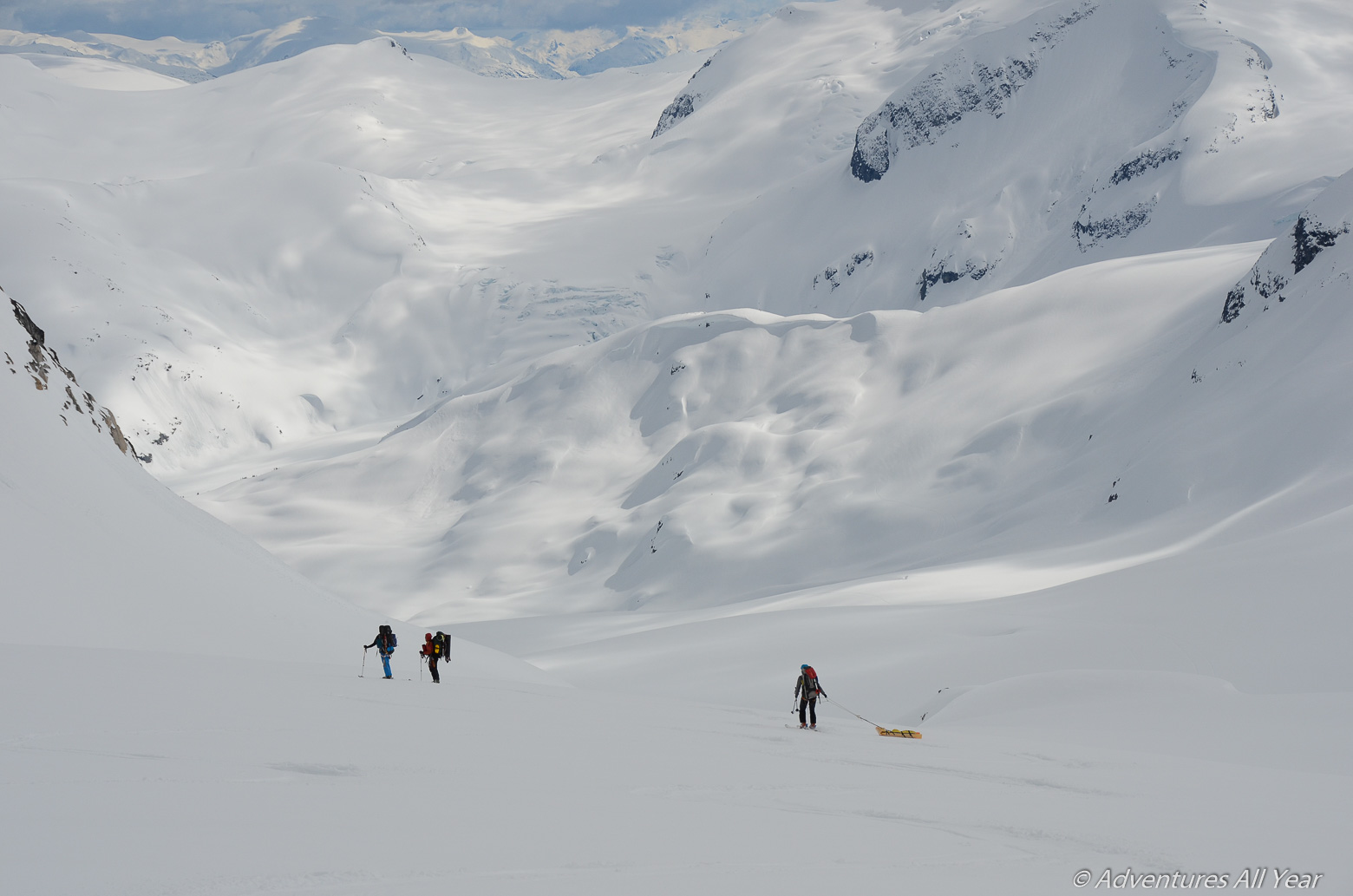
After two hours of tiptoeing around the open water traps we finally emerge on the flats at the N end of the canyon. From there it is just one final steady uphill push to reach the icefield W of White Cross Mountain. En route we are passing close to some big alpine faces – surely not a place to be in high avalanche danger. Once we top out from the W Salal Creek drainage we follow the undulating terrain with White Cross Mountain behind us. As we stop to eat a snack I noticed the biggest sundog of my life. Sundogs are a harbinger of bad weather to come. Oh, are they right.
Day 3: White Cross Ridge to Pier Mountain
(April 17, 2017; Distance: 3km; Elevation Gain: 283m; Weather: some visibility during breakfast, deteriorating to a white-out, then blizzard.)
We wake up to an overcast day. While we pack camp the clouds descend and encapsulate us in their milky white. We manage to cover only 3km before we can no longer see anything. We make camp early that day in a less than ideal spot on an edge of some mountain. The visibility drops to zero. The earth and the sky blend in a uniform shade of white paint. We stake out a 10m safety perimeter around camp as we cannot decide whether we are perched on a cornice or a cliff. By late afternoon the weather sets in fully. It is blowing snow, light at first, then heavier and denser with each passing hour.
Day 4: Stuck In a Blizzard
(April 18, 2017; Distance: 0km; Elevation Gain: 0m; Weather: all-day blizzard)
Positively not going anywhere today. Around 3pm I get called in as an arbitrator in a Scrabble game dispute. As an ESL I marvel at the choice but do as asked and issue rulings arbitrarily, waving off the protesters and enjoying the powers thus bestowed upon me. The rest of the day is spent loitering in the camp’s safety perimeter and digging outhouses and other civic structures.
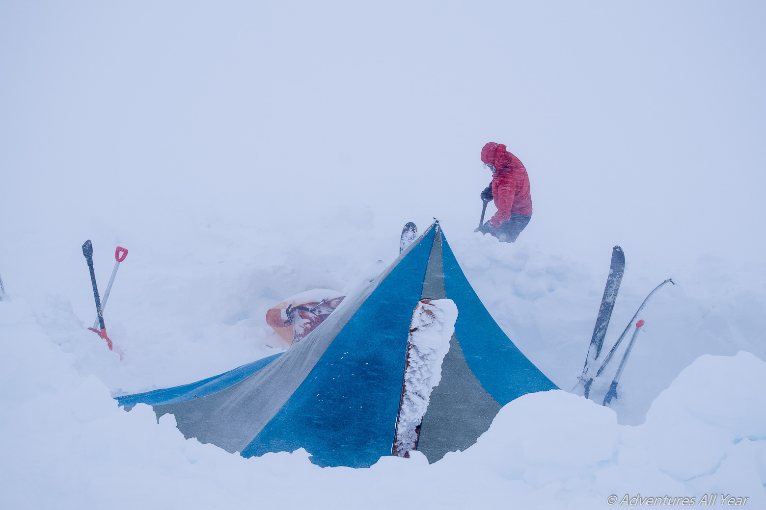
All the fun and action happens at night when we need to assign a midnight shift to clear snow off the tent to prevent it from collapsing. At midnight, one of us dons, inside the tent, a full body weather protection outfit including hat, gloves and goggles. The unlucky individual is then unceremoniously shoved outside the tent to fulfill his/her shoveling duties. After the job is done the person is begrudgingly received back inside the tent where they undergo an assisted gear doffing procedure. The cycle repeats at 3am and 6am.
Day 5: Stuck In a Blizzard
(April 19, 2017; Distance: 0km; Elevation Gain: 0m; Weather: all-day blizzard)
It has not stopped snowing since we first made camp here which was an eternity ago. By now, we have dug six outhouses. They all get filled in with drift snow within hours and then people refuse to step inside them for the fear of – you know what. The time passes slowly, the world shrunk into a white ball 10m in diameter. We become obsessed with barometers, triumphantly reporting the tiniest move towards a higher pressure reading. They are all false positives.
Day 6: Stuck in a blizz…No, wait. Pier Mtn to Upper Bridge Glacier.
(April 20, 2017; Distance: 10.7km; Elevation Gain: 681m; Weather: visibility breaks in morning, clear rest of the day)
The impenetrable cloud moves away in lazy drifts and in moments of clarity we see down to Bridge Glacier and all the wonderful landscape we came here to worship. On our horses!
The mellow ridge to Pier Mtn is negotiated easily (we are also well rested 😉 and the ski run down to Bridge Glacier very enjoyable. Here we each get an opportunity to make friends – best ski buddies – with our sleds to the point that they are given nicknames. It is here that the Flying Burrito earns its name. So does PITA. We laugh, act silly, take pictures.
The general merriment lasts until the moment when Radmila breaks her ski binding. The metal toe plate splits, with the failure line running through the attachment screw. We unsuccessfully attempt a field repair but are forced to make an early camp about two thirds up Bridge Gl (which is IMMENSE, by the way, with huge crevasses down its centre). Not a bad spot for a camp, with the impressive Bridge Peak looming above us, but the mood is not cheerful and some whiskey is consumed to facilitate further decision making.
Day 7: Upper Bridge Glacier to Ring Glacier
(April 21, 2017; Distance: 12km; Elevation Gain: 549m; Weather: clear)
The binding is still broken and it’s a terminal loss. There is no other choice but to make arrangements via a satellite phone for Radmila to be flown out today. We take photographic evidence of the gear failure, we curse, make fists and threaten to make Black Diamond pay for all of this.
Around 11:30am we hear a distant thump of a helicopter and for Radmila the traverse is over. Our team shrinks to five souls. After she’s gone we squabble over who gets the Serbian sausages from her provisions. The fist fight settled, we continue up mellow Bridge Glacier, skirting Stanley Peak from the S side, to an obvious col. From here the views on offer are: Bridge Peak, Stanley Peak, Mount Alecto, many other mountains, and a glimpse of Mount Waddington in the distance.
We ski down due W, choosing to keep to the left of the rocky rib and skirting a bit of an icefall to the skiers’ right. We uneventfully ascend Ring Glacier to its apex just NW of Mt Alecto and we make camp for the night.
Day 8: Ring Glacier and Around Lillooet Mountain
(April 22, 2017; Distance: 13km; Elevation Gain: 739m; Weather: high overcast in morning, whiteout started at 2pm)
In the morning the clouds roll in and start enveloping us in a milkshake as we ski down the other side of Ring Gl. Those suffering in whiteout conditions suffer. Under better visibility the ski down would likely be rated as pleasant.. Having descended Ring Glacier we arrive at a Four Way Stop which has now, after three decades of glacial recession, become only a Three Way Stop.
This is also a point where Lillooet Glacier takes off to the east and eventually becomes Lillooet River. This was out planned emergency exit route, should we need to cut our trip short. But, being young and foolish, we continue up and towards Mount Dalgleish.
As we are looping W around Lillooet Mountain Glacier a light blizzard develops. This happens shortly after entering an area marked as “big, open crevasses!” on our map. The (in)visibility soon forces us to go only by a GPS. We rope up and entrust ourselves into Aaron’s mad route-finding skillz.

Tired, we finally make camp around 6pm in a less than ideal spot under a wall of something big (serac? A Snow White castle?) lurking nearby from the impenetrable mist. We poke around carefully with probes and move ~3 tons of snow just to make a basic camp.
Day 9: Dalgleish Neve and Over Mu Col
(April 23, 2017; Distance: 10.8km; Elevation Gain: 577m; Weather: intermittent clouds, in and out vis in morning, clear in afternoon)
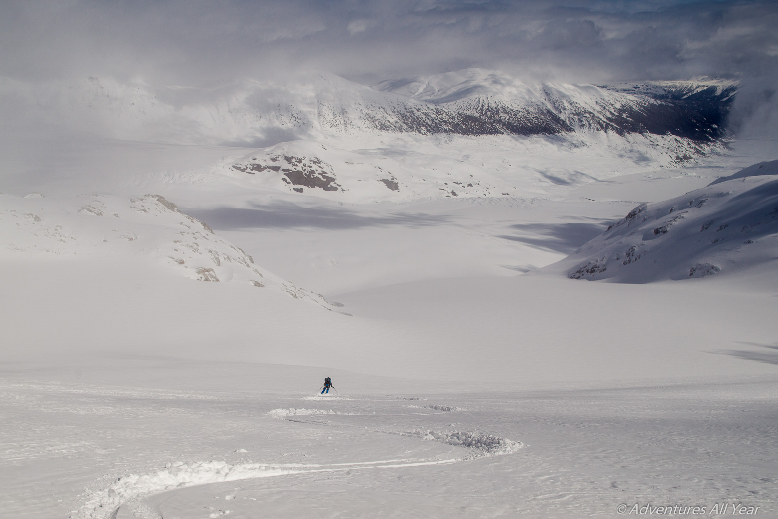
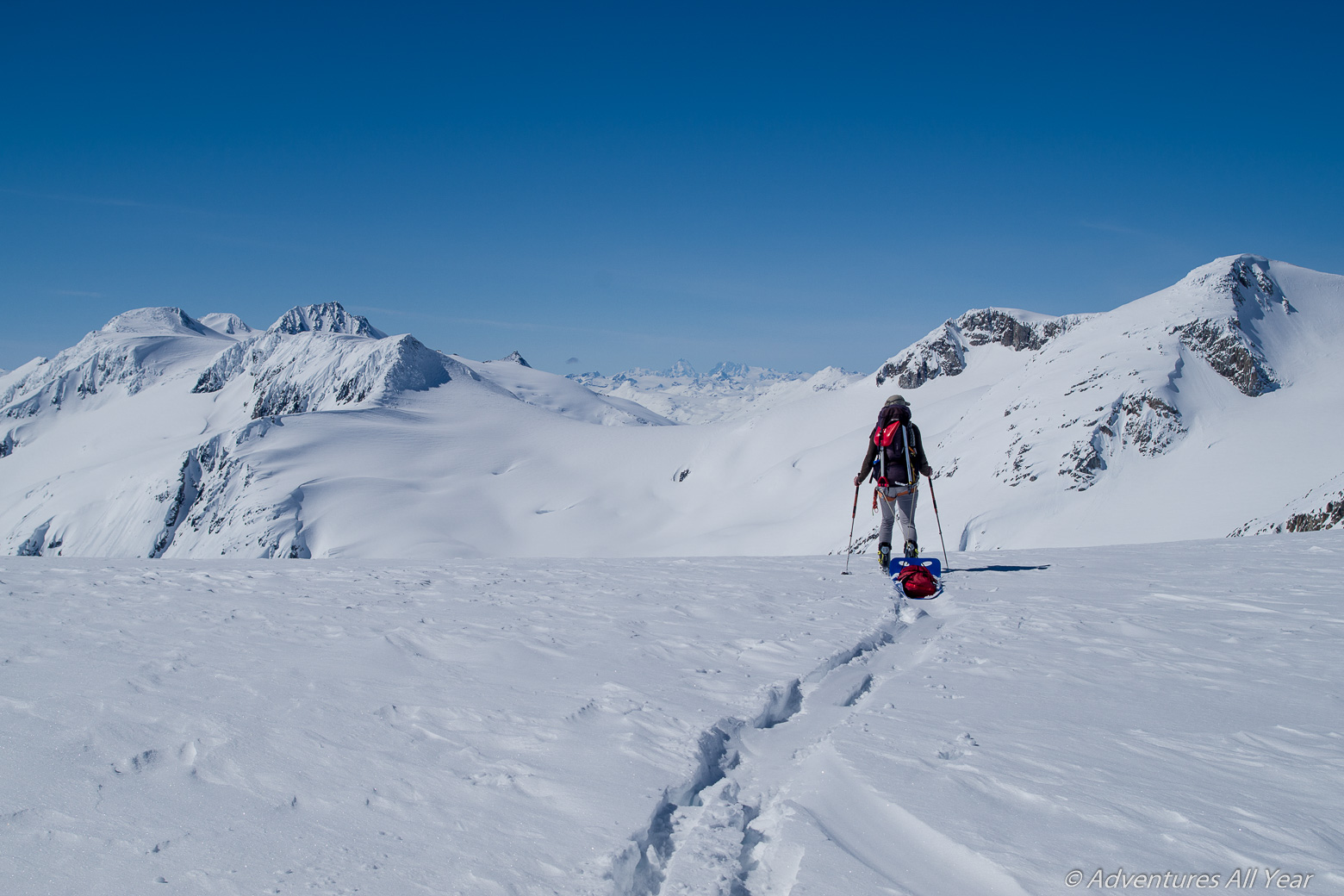
We wake up to something that might turn out to be a sunny day. Not too many of those on this traverse, that’s for sure. We curl around the W and S side of Lillooet Mountain and top out at a broad col from which we get a great view of the Dalgleish Névé expanse. As we ski eastward and across it, the sun finally penetrates through the cloud and illuminates the snowflakes falling from the sky. Millions of tiny diamonds dancing through in the air.
We had no time to linger and no time to climb Dalgleish peak. We were now so seriously behind the schedule that we couldn’t risk another no-viz day. So we put our heads down and ascended to a high col in the SW shoulder of Mu Peak. I am not embarrassed to say that the view from that col took our breath away. This is where we got our first glimpse of the Wahoo Tower and the peaks in the Manatee group, from here we could see down to Zoltan Creek and follow it to where it meets the main Toba Valley. We visually scouted the entire area, it was clear we were deep in the coastal mountains with their tumbling glaciers, steep mountain faces, deep cut valleys and powerful rumbling of the water in the creek far below us.
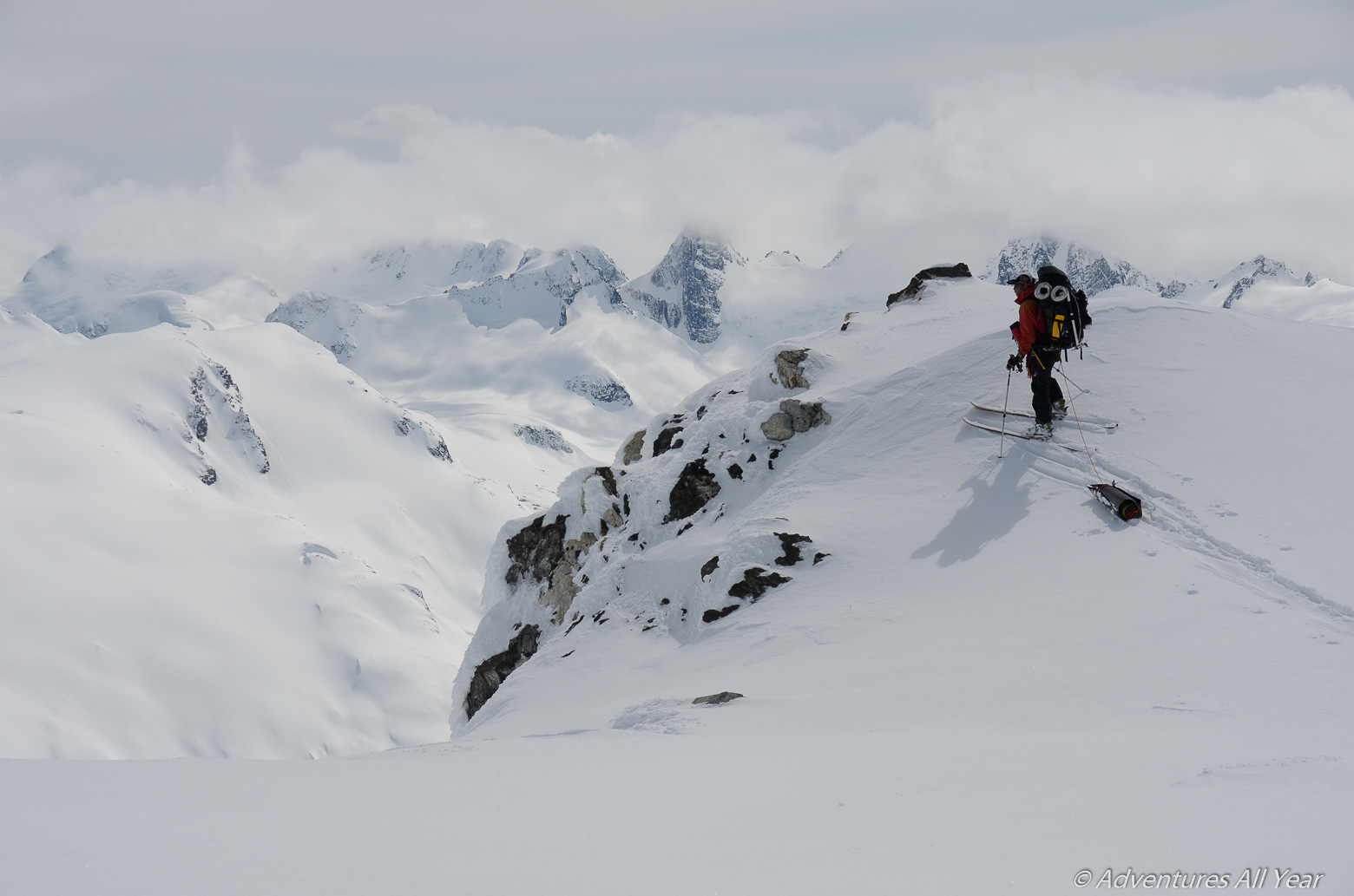
We still had a big job to do – getting off the Mu Col which involved a short steep down climb but took much time as we set up an anchor to belay everyone and the sleds on this ~30 ft pitch. Once down this step we had to traverse across a 35 degree big alpine face on the S side of Mu Peak. By this time it was 3pm and the sun was pounding the face with its almighty force. It sure made for some long minutes as we nervously watched each other ski, one by one, across the face and to a safe spot. Thinking that we have cleared the crux of the trip we settled down for a very cold night on Mu Ridge (-17 C).
Day 10: Mu Ridge to Obelia Peak and Down to Manatee Creek
(April 24, 2017; Distance: 12.7km;. Elevation Gain: 693m; Weather: overcast in morning, partly cloudy in afternoon)
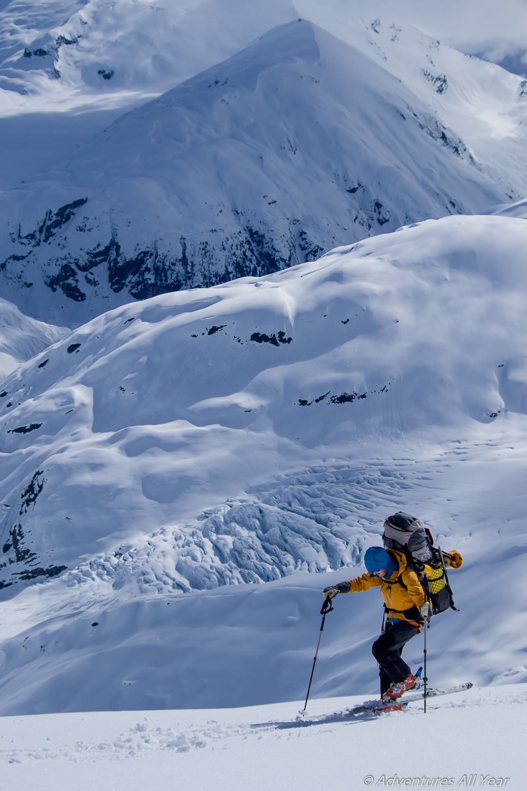
Mu Ridge is freaking scary. This is not the experience of previous parties, if you ask them, but for us it was a reach into the depth of one’s brave soul. This was due to the snow conditions – hard and frozen, no boot penetration, and to the fact that we were unable to really follow this undulating ridge. On multiple occasions we were forced to traverse its steep western slopes. I made a major mistake of not removing my skins for this traverse. Realizing that I would have better edge control without I was forced to remove them in a 45 degree slope. This took a lot of cursing and anxiety. The incline was so bad that I needed to peg my backpack down to the slope with an ice-axes to prevent it from tumbling into oblivion and was still sweating bricks that I would lose a critical piece of equipment. Stepping back into the stripped skis was almost as much fun, where Peter had to hold the ski for me to make sure it did not shoot down and out of sight forever.
Obelia Peak and beyond, on the other hand, offered nothing but a fantastic run down a glacier and into the Manatee Creek drainage where we camped for the night. The views were stellar too.
Day 11: Up Manatee Creek, across Mosaic Glacier and down to Job Glacier
(April 25, 2017; Distance: 15.5km; Elevation Gain: 1,197m; Weather: intermittent clouds, visibility decreased in middle of day, improved in late afternoon.)
So close, yet so far away. During the days of Meager Creek forest service road (and prior to the Aug 2010 Capricorn Creek landslide), all one would have to do from this point on would be to leisurely cruise up onto Manatee Glacier, glide through that and be home free in no time.
However, we had to veer NW and across Mosaic glacier to access the Lillooet Valley by crossing the Meager-Capricorn group. The mean weather gods dealt us another snowy day where in complete whiteout towards Mosaic Glacier we again had to go only by GPS. This was where the home preparation of the route hugely pays off because we were able to follow the best route despite not seeing anything, really. At one point everything was so white that we had to throw a 30m rope ahead of us just to see where the “down” was and what the angle of the slope. By some miracle we reached Mosaic Glacier and it was nothing as expected. The terrain here was supposed to be almost flat, according to or topo dated from the 70’s. Instead, the glacier in front of us was quite receded and fairly steep, we were virtually traversing accross its headwall. Once across, getting onto the ridge NW of Job Glacier required another steep traverse. A smart thing to do here would have been to bootpack it up but I did not really care anymore whether I was gonna die there, that day, in a 200m slip down to the bottom of the glacier. So I kept on skinning.
Day 12: Out Via Job Creek to Lillooet River Valley
(April 26, 2017; Distance: 14.6km; Elevation Gain: 352m; Weather: stormy/whiteout in morning, clearing by noon, sunny in the afternoon)
We are now officially one day overdue. Yet we woke up still ways away from the car. The previous night we managed to ski down to Job Glacier without an incident although in a whiteout, and made hopefully the last camp on this trip. In the morning we took a good deal of time scouting our exit route. Today we should ski off the glacier and find our way to the main Lillooet River Valley.
This proved to be an exciting endeavour which involved skiing down a 45-50 degree moraine on isothermal snow. And things went downhill from there, excuse the pun. After we cleared the moraine the terrain sucked us into the Job Creek Canyon. The Job-Meagre group is made of soft volcanic rock so when a creek flows through it, it does a good number on it. So at 11am on this beautiful day we found ourselves clinging to the steep sides of the Job Creek canyon, traversing on the remains of the winter snow cover, trying not to fall in.
At some point the canyon walls close in and constrict us to a single passage. Here we are forced to descend to the creek level and cross it on a snowy pillow that miraculously remains, unmelted, in the right spot to allow us to cross to the other side. Here I experienced a true “engine-flush” – a rush of adrenalin when waterlogged soil in the gully we were crossing started to slide down in one muddy avalanche. I ditched the skis I had been carrying and only had a split of a second to roll to the side before the boulders shot past me. My skis were taken for a ride though and I had to, heart pounding, re-enter the unstable gully to retrieve them.
After being tried by the Job Creek we finally saw a clear way out and rejoiced upon emerging in the Lillooet River valley. Feels like we’re almost out but there is still so much work to do. We follow the flats on the west side of the river, crossing Affliction Creek and a couple of its channels / tributaries without a problem. We start seeing some snowmobile tracks. They were all aiming up the Affliction Creek valley on an old road bed.
Finally, around 5 pm we reach a prominent FSR which traverses at the foot of Plinth Peak. Following this road we work our way out over massive avalanche debris. Plinth Mountain east slopes, when warmed up, produce large wet slides, some of them hundred or more meters wide that spill over the road. Whenever these slides happened, a few days prior, we sure were glad we weren’t around.
And finally – hallelujah – we see our car, patiently waiting for us at km 49 of the Lillooet FSR. Only a bridge over Keyhole Canyon now separates us from successfully completing this trip. We made it!

Leave a comment