This is a beautiful, rarely done traverse in the very backyard of Squamish. Washed out logging roads now make it a bit more complicated to access but it is still very much doable for a dedicated party. The reward will be an absolute solitude just 50 km west of civilization and fantastic views of the seldom seen ridges and valleys.
The following is a trip report from late April of 2008 when our group of four did it over 4 days. I hope it’ll provide some useful info when planning your own traverse of the Ashlu-Elaho divide. The disclaimer is that the route we took might or might not be passable today because glaciers move. The exit at Porterhouse Peak end, which we feared the most, was no problem back then and should be still good today. The 20-km walk on Ashlu Main back to the car was not fun back then and would not be good today either. Would I pay $1,400 for a heli pick up if I had that money? Maybe…but we all have our own adventures 🙂
Day 1
To get to the start of the route we drove on Ashlu Main Rd to km 8.5 and turned off onto A-700 where we parked the car at a washout at Buck Slide (N49 56.174 W123 21.702). We forded the creek and walked on A-700, turning onto A-730 and finally onto Mt. Wood Spur just before A-730 crosses Pykett Cr (~8km on logging roads total). We encountered thick slide alder on A-730 before Stuyvesant Cr which we had to ford as well.
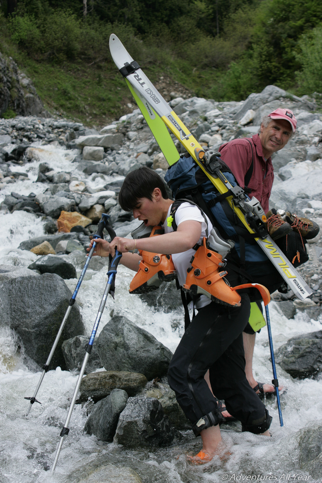
To reach the Ashlu-Elaho divide we used a ridge on the E side of Pykett Cr basin turning off from Mt Wood spur road and into the trees at N49 58.362 W123 25.369. That’s when the fun begins – the forest is steep. A thin layer of wet firn slid easily on top of a hard layer so we used ski-crampons for a better grip. The situation was rather inconspicuous but would have been treacherous without this great help. Steadily gaining elevation (1600m total from the car) we reached high ground just west from where steep slopes drop into the drainage of Stuyvesant Creek and made Camp 1 (N49 58.399 W123 23.967).
Day 2
Next morning, while packing tents, Clé managed to drop one of my tent poles. Not a big deal, except – she dropped it and it glided and glided over spring snow for about 500 vertical meters, all the way to the valley bottom. I did not have enough willpower to go down and retrieve it – a decision we came to regret the very next night.
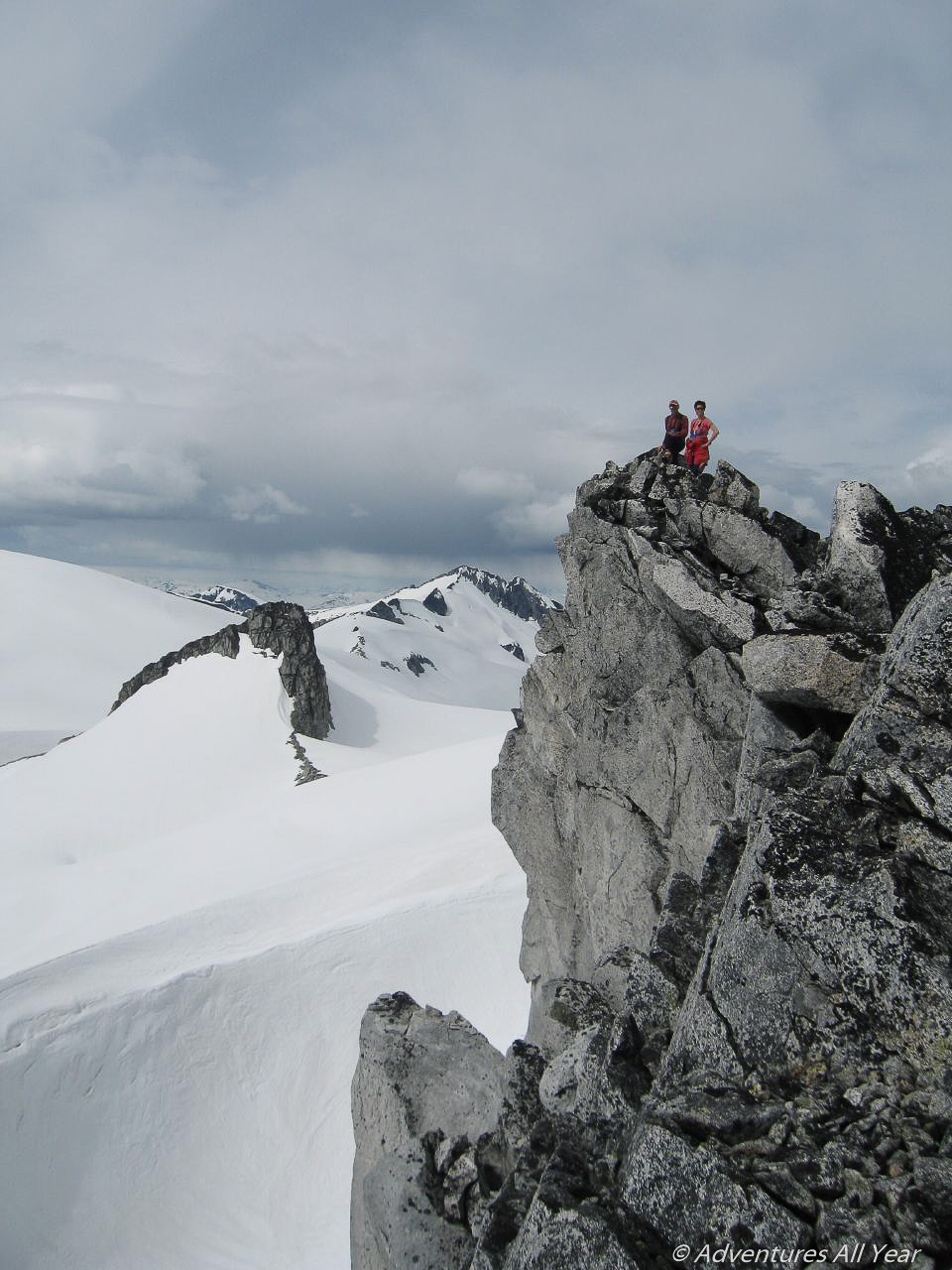
After packing camp continued on to Zig Zag Peak, dropped our packs on the glacier NW of Zig-Zag, climbed it for an awesome ski back down and continued NE through a pass further north to gain gentle slopes east of Mt. Storey (a.k.a. Mt. Wood). A short steep slope gave access to just below Mt. Storey’s summit, which we also climbed. Then we continued towards Mt. Charlie Charlie. The terrain was relatively mellow and we only had to climb a short steeper section on glacier due east of the north summit of Mt. Charlie Charlie. We dropped packs once we reached a flat spot on the glacier and headed out to claim the south and higher summit of Mt. Charlie Charlie. There was some scrambling involved with a slightly airy gap only feet away from the top.
Continuing on towards Pykett Peak we needed to gain 500 ft more to reach a huge wind cirque at the foot of Pykett Peak where we made Camp 2.
It rained hard that night. Our improvised one-pole shelter leaked badly. Both me and Clé spent the night sitting in the only semi-dry spot under the improvised tent canopy. Not much sleep was had.
Day 3

Peter and Silke, all burly in the morning, headed to climb Pykett Peak. After their return to camp we contoured the glacier west of Icecap Peak to gain the col W of the summit. The German power couple then headed off to bag that peak too, first trying the W ridge until the slopes become broken up with bergschrund. Fortunately, a narrow gap allowed access back over to the SW slope and the S ridge which was an easy scramble. From Icecap Peak we continued along the ridge stretching W of Icecap Peak and down the glacier to the pass with Amicus Mountain.
To get up to the col W of Amicus Mtn we had to do a nasty long bootpack as the terrain was too steep to skin up and prone to wet snow sluffs under the snow conditions we encountered. The weather caught up with us at the col W of Amicus Mtn so we made Camp 3.
Day 4
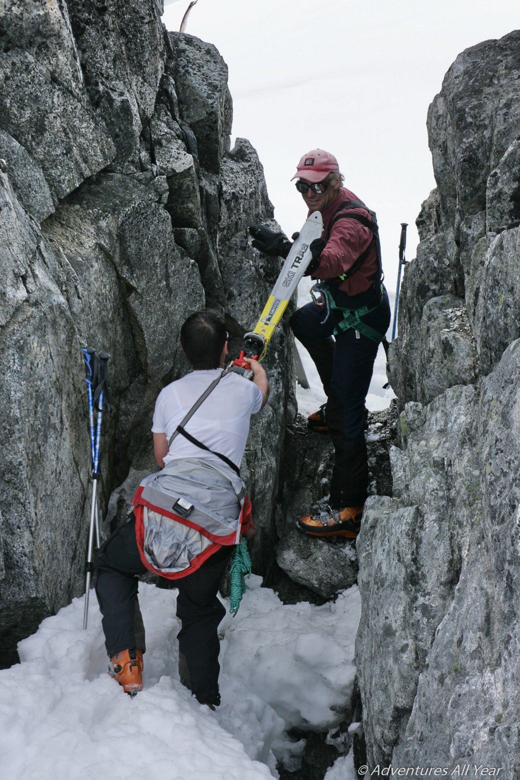
In the morning Peter and Silke added Amicus Mountain to their collection of triumph and we continued west across the icefield. Crossing this part was an adrenalin sport as the glacier is fairly open and we had to navigate around numerous open crevasses, sending Peter first into harm’s way. Ashlu Mountain and Porterhouse Peak came into view as we were approaching the W end of the glacier. By the time we reached the narrow gap immediately east of Porterhouse Pk we were in a whiteout again. We had to wait for the clouds to lift a little as the next part of the route was critical – the way out.

To descend from the divide we used a ridge that stretches S from the gap on the E side of Porterhouse Peak. We stayed high on the W slopes of the ridge, always traversing back to the ridge where possible and reasonable, avoiding cliffs and rock bands. It turned out to be a relatively easy and safe way down past the Porterhouse icefall. We exited the glacier basin via a ‘gate’ (N50 01.951 W123 32.147) between bands of rock that constrict its S end and skied out via a narrow chute that most probably hosts a small waterfall in summer.

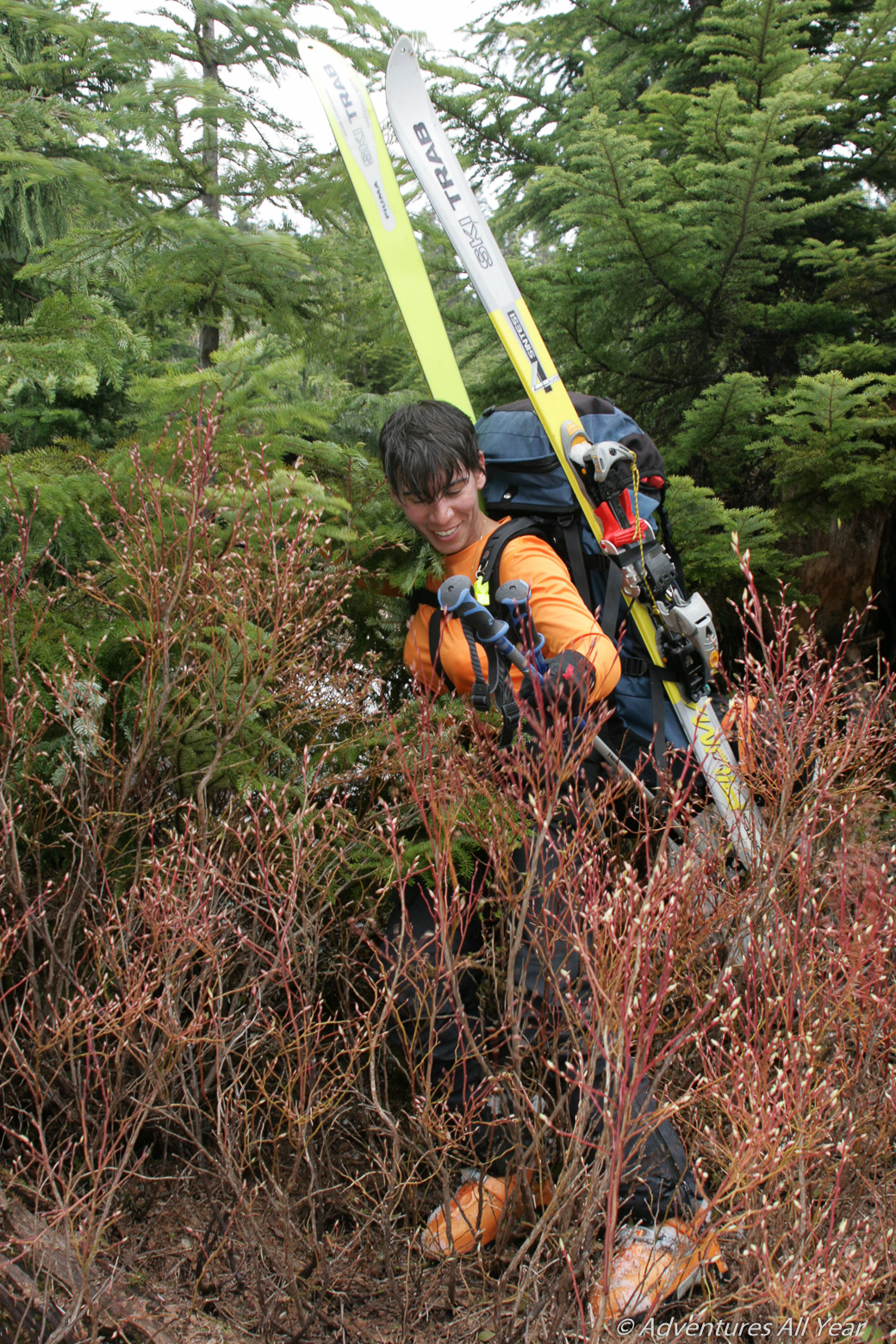
We followed W side (true right) of Porterhouse Creek down to A-1400 logging road only to find out that this spur was washed out by raging Porterhouse Cr. Forced to bush-bash we instead continued through a clearcut all the way down to Ashlu Main which we reached at 3:30 pm. All there was left is to do was to put the skis on our backpacks and WALK 20 km on Ashlu Main back to the car. Home by 1 AM.
Gotta love BC!

Leave a comment