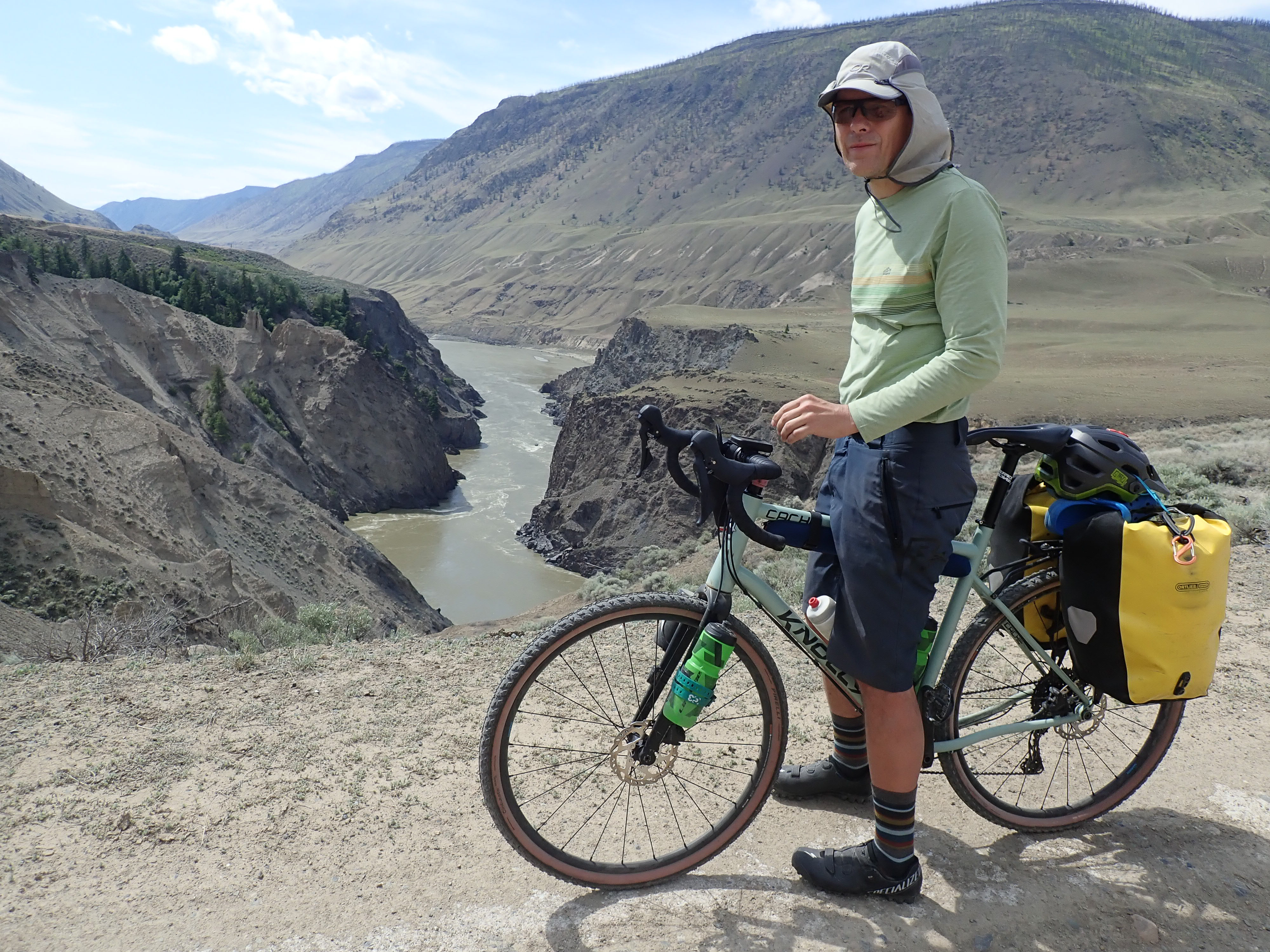
We are now three days into our bikepacking trip around the Fraser River. Both of those previous days were spectacular for the views but not easy. Just yesterday we did a cumulative 1,800m vertical gain and now I am here, into my second hour of pushing the loaded bike uphill on a steep forest service road.
Me: “I don’t understand how this guy did this entire route as a day trip”.
Hubby: “Which guy?”
Me: “The guy from dirtbiking dot com who gave me the idea and the GPX track.”
A moment of stunned silence.
Hubby: “You know what a dirtbike is, right?”
The Highlights
- Sculpted hoodoos and other geological formations carved out of the river banks
- Working farms and ranchlands along the West Pavillion Road
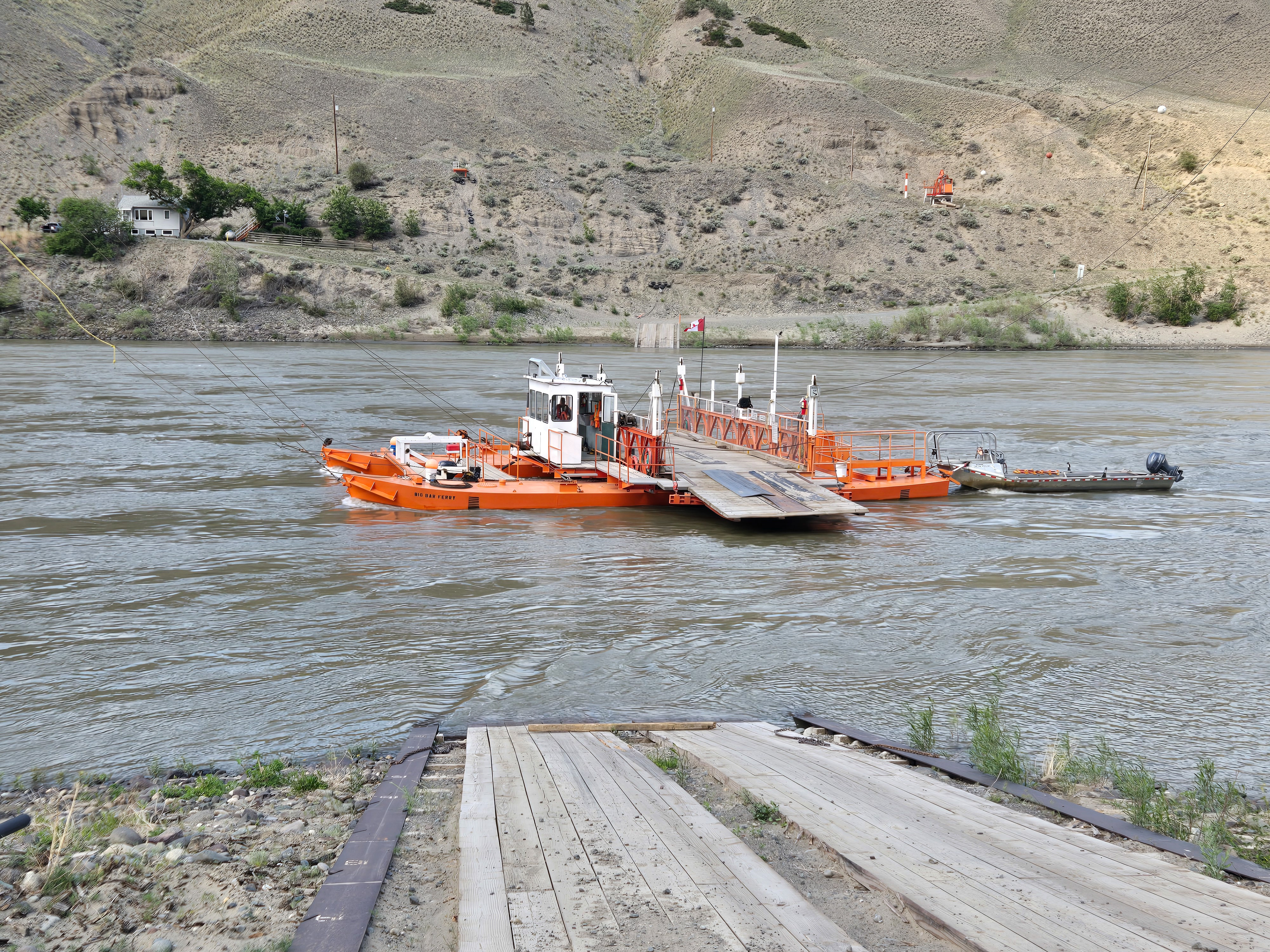
- Big Bar reaction ferry – an engineering curiosity
- The ranching history and views along the High Bar Road
- The Cougar Point viewpoint
- The ranchlands plateau between Kelly Lake and the village of Pavillion
- Old wooden bridge in Lillooet (pedestrian traffic only, bicycles OK)
Trip Stats
We have been planning for this trip for a long time. We knew it was not going to be an easy one – the route planning stats were indicating 210km in length and 5,400m elevation gain total. We needed to carry camping gear and food for three days. And we needed to work up some stamina for this physically demanding bike packing trip.
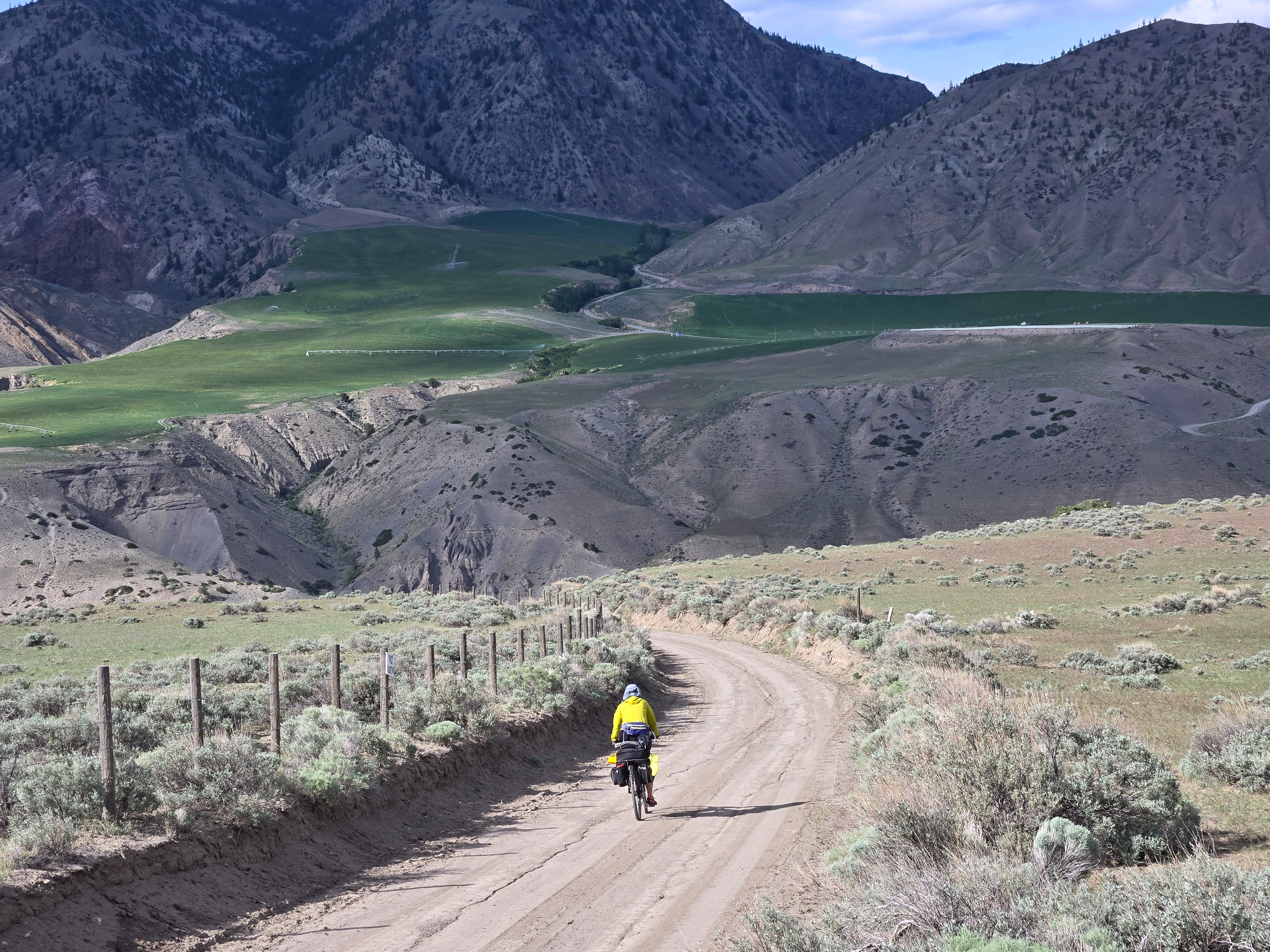
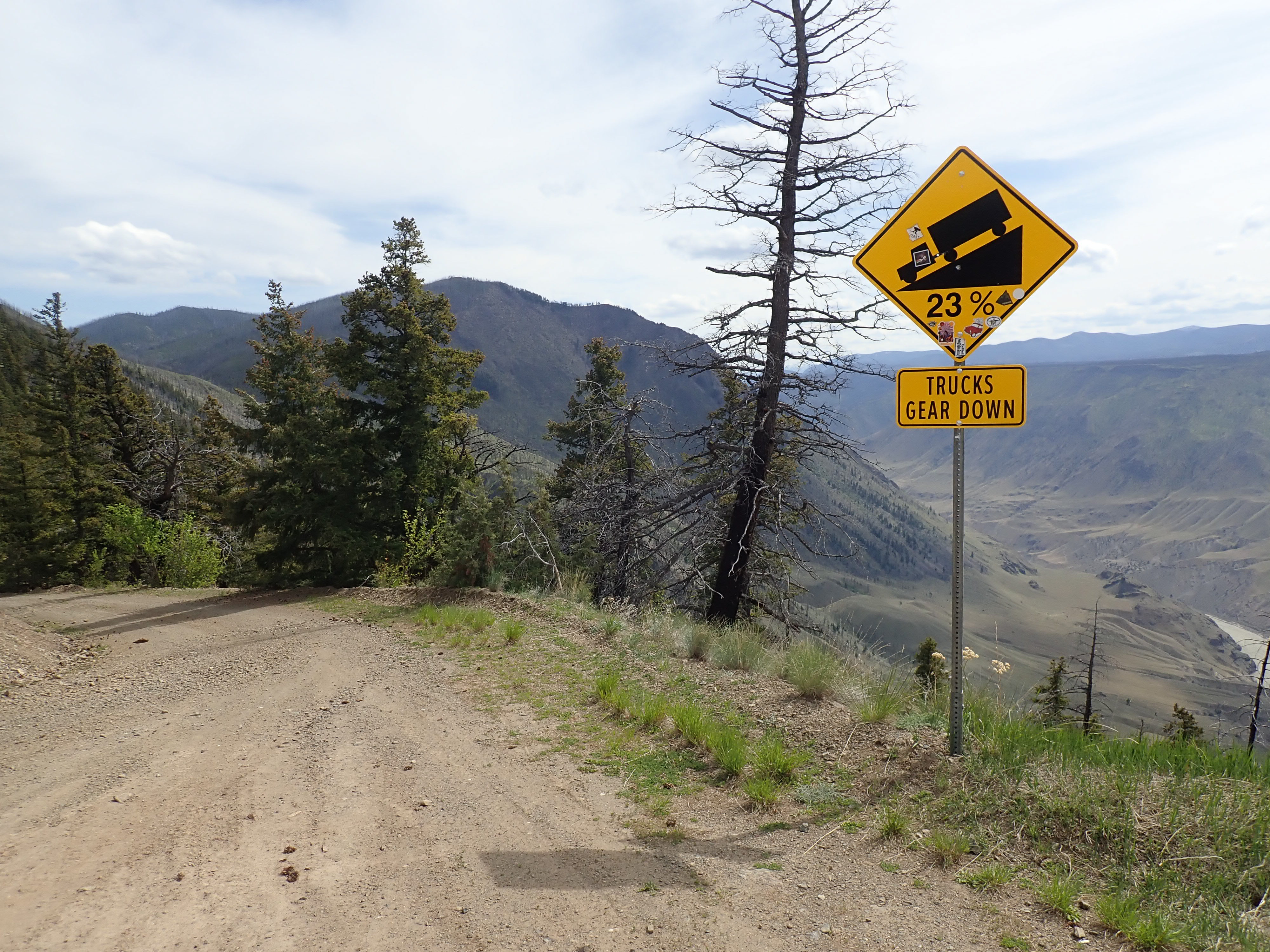
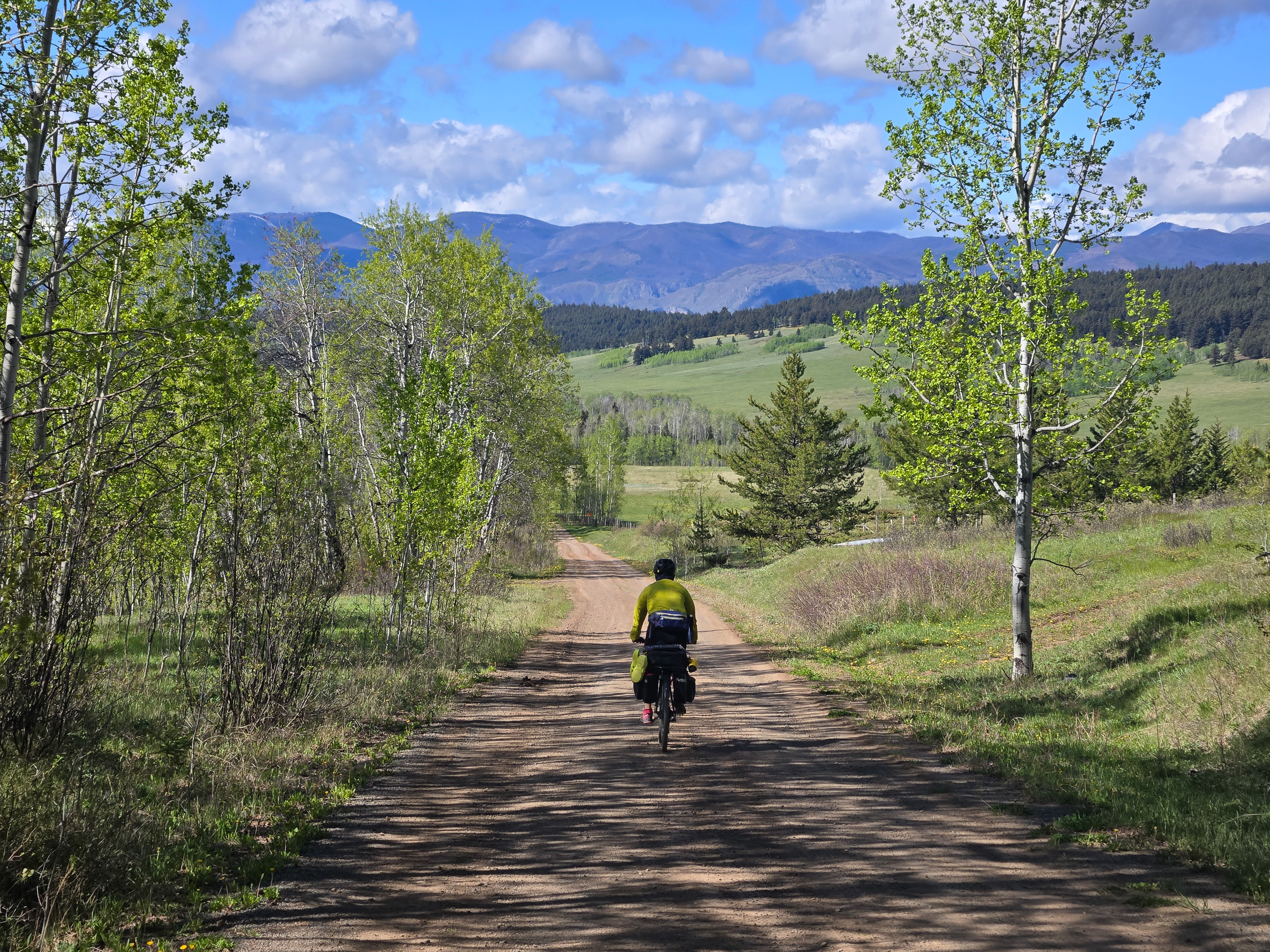
The route mostly leads through an open country with spectacular views up and across the Fraser. The roads, with their firm surface save for a few loose gravelly spots, are great for gravel bikes but the grades are relentless: typically 11-15%, with an occasional 20% incline. Prepare to push your bike on those.
The rewards were more than worth it. Despite the sweat and struggles on steep hills, we came
back with huge grins and elated from a trip through these spectacular landscapes.
Route Description
The route starts in Lillooet, where you can leave your car parked on the Main Street strip, and heads north on Moha Road. After about 6km out of town is crosses Bridge River which carves an interesting narrow canyon before emptying into the Fraser. Notice the salmon drying racks on the rocky outcropping near the confluence of Bridge and Fraser.
The road then turns onto gravelly surface of West Pavillion FSR and starts climbing stiffly. The West Pavillion FSR closely follows the mighty Fraser River on a broad high bench with views of working cattle ranches. About 100km N of Lilllooet the route drops down to the river at Big and uses the tiny Big Bar Ferry to cross to the other side. It then follows the High Bar FSR back south on another wide bench high above the river. The return to Lillooet is via Jesmond FSR and the Pavillion-Clinton paved road (Hwy 99).
Water Sources
Water can be scarce on the first 50km of this trip, especially later in the season. Some of the bigger creeks (from south to north: Blackhill, Slok, MaKay, Leon, Watson Bar, Ward and on the other side of the river from north to south: Big Bar, Indian, Kostering, Barney) will always run but do bring some dromedary bags so that you have water storage capacity and are not reliant on camping near the water sources.
Where to Camp
There are many places where you can camp, even if it is on a side of the road. West Pavillion FSR does not have too much traffic (we saw 4 cars in total on our 1st day). The traffic on the High Bar FSR (east side of the river) is non-existent. For the whole day we did not see any other person, motorized or not.
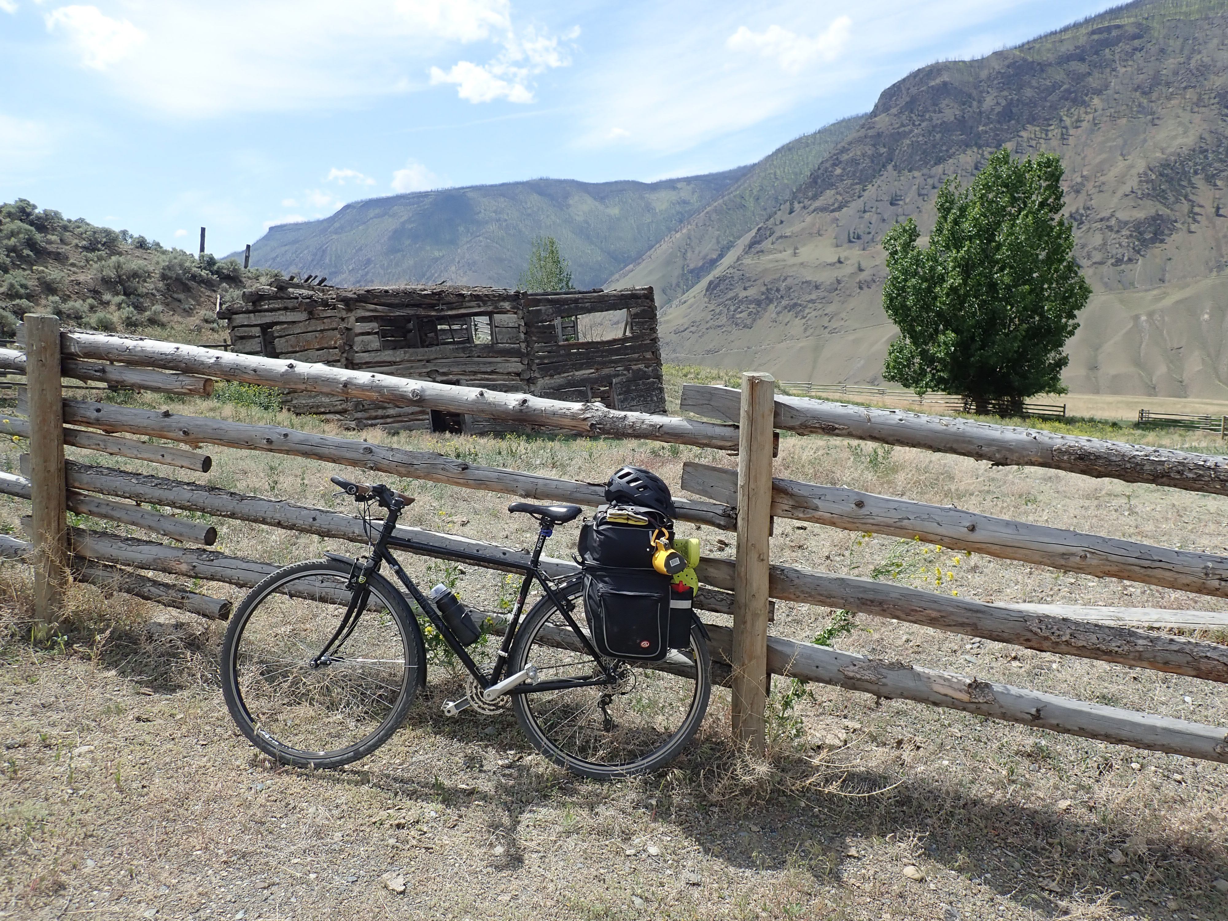
History
High Bar Road and the surrounding area on the river bench has a very interesting ranching history. Some of the very old log ranch buildings remain and the root cellars are still visible form the road. A great way to get to know the place you are about to visit is to read about its history beforehand. You can read some here: settler’s life on the ranchlands, the High Bar First Nation perspective, the Kostering Ranch history.
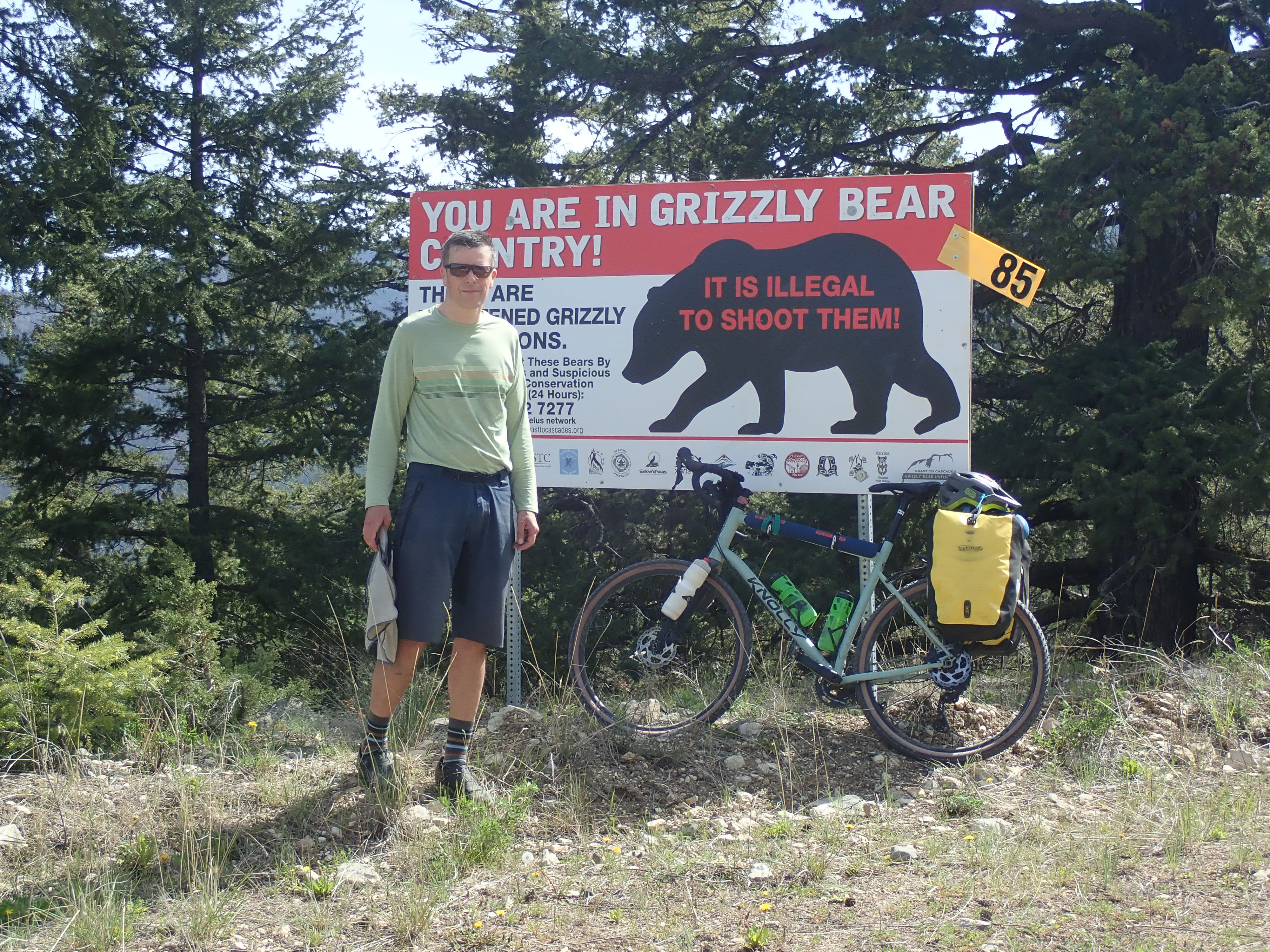
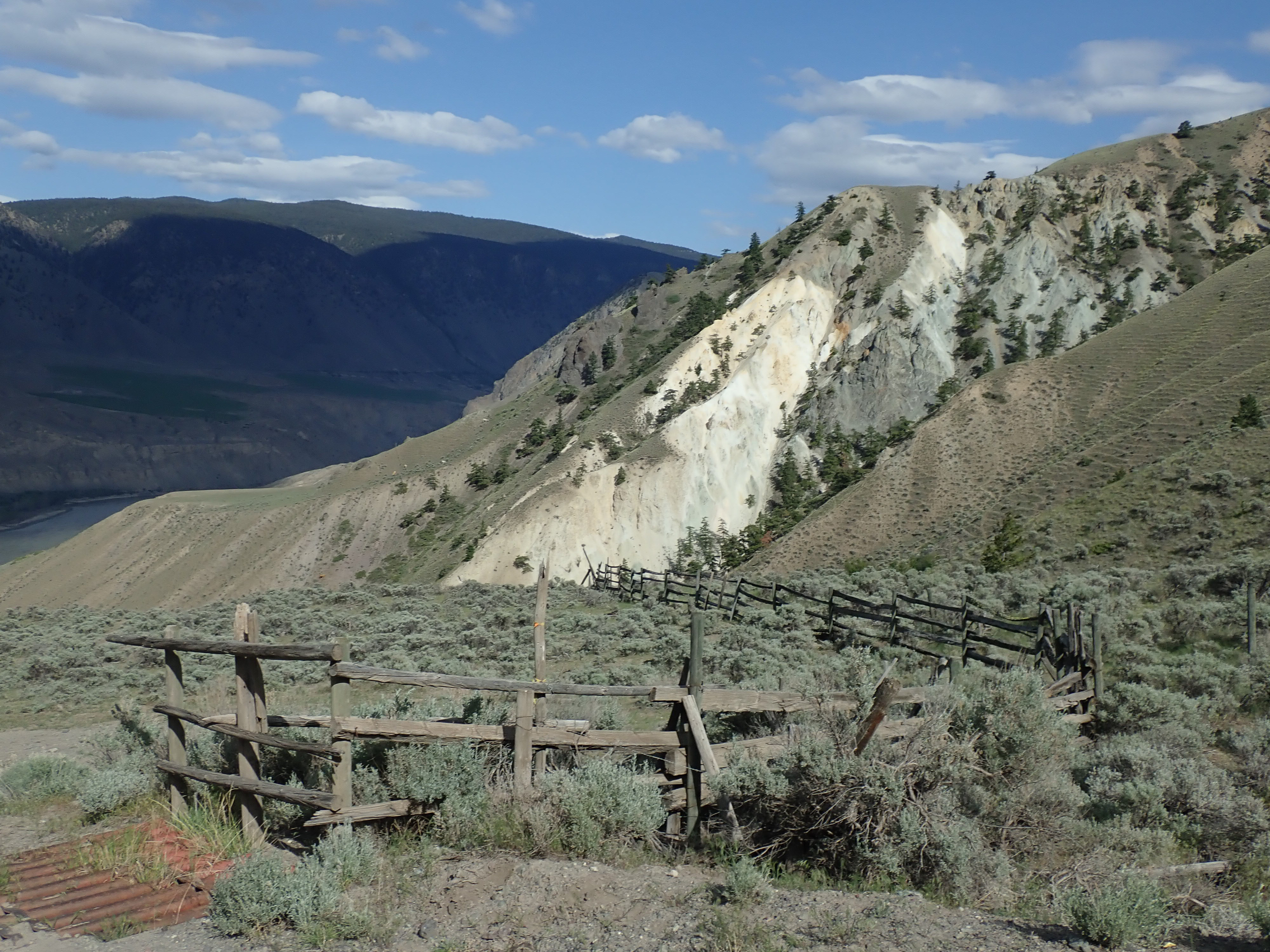
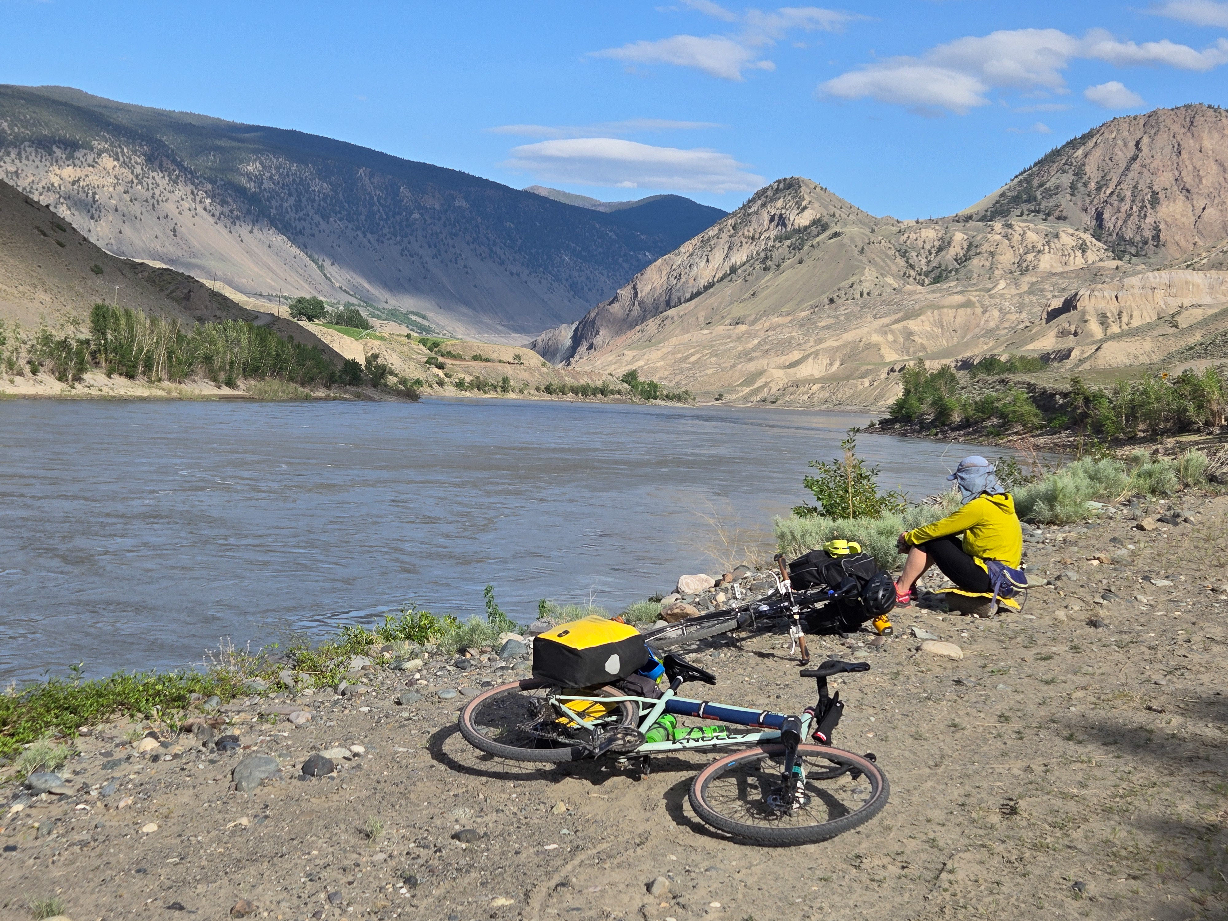
The rest of our trip is retold via captions in the photos below. Enjoy!


Leave a comment