On December 7, 2014 a large rock slide flooded the Seymour River canyon taking out an important pedestrian bridge linking the west and east side of the river. The decommissioning of what was once known as Twin Bridges resulted in some popular hiking loops being no longer viable.
Five years later and Metro Vancouver has a new 75 m suspension bridge connecting Lower Fisherman’s Trail to the trails on the west side of the river. We had to check it. Riding our city bikes from Mt. Pleasant area and following Adanac bike route we crossed Second Narrows Bridge and headed towards Riverside Drive on the North Shore. Shortly we were out of the traffic and riding on a pleasant residential street with beautiful houses lining both sides of the Seymour River (creep alert: I love peeking into people’s backyards, if visible from the street/alley, of course). The Riverside Drive ends at the lower Fisherman’s Trail trail head. From here the pavement turns into hard packed gravel but is still suitable for riding on a commuter bike.
An interpretative kiosk about 2 km into the Fisherman’s trail stops at the site of the 2014 rockfall. The trees somewhat obstruct the full view, nevertheless the scar in the side of the mountain is a stark reminder of how geologically active and ever-changing the coastal British Columbia is.
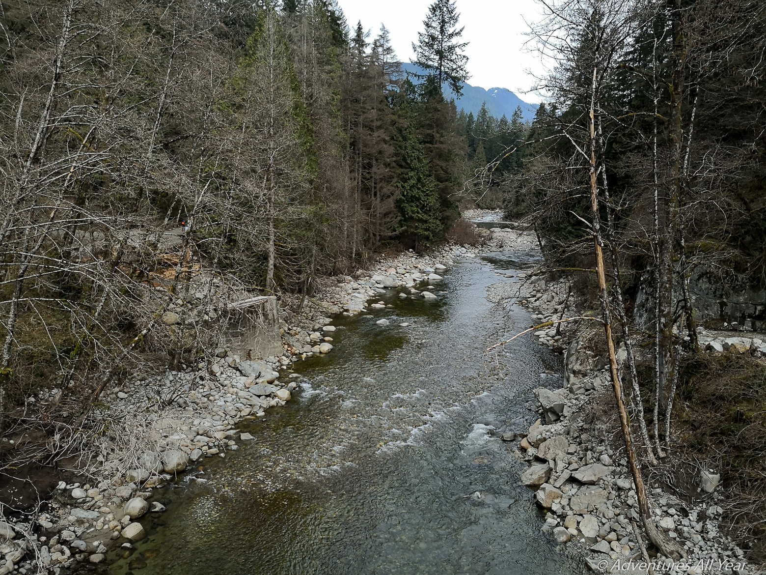
After about 20 mins of riding on the trail we reached the new suspension bridge. It is a work of beauty and much larger than the old Twin Bridges. After the obligatory selfie taken at the apex of its span we continued on Fisherman’s Trail on the west side of the Seymour River. Numerous improvements have been made to the trail itself and what before used to be a single track with many boardwalks is now now a wide, flat, bicycle-friendly trail following a beautiful mountain river. A mental note for the summer: adjacent to the suspension bridge is a sandy beach and a large inviting pool of calm green water.

Wanting to make this outing a loop we climbed out of the river valley following Homestead Trail (second turnoff to the left, after crossing the suspension bridge. The first turnoff is immediately after the bridge, it will also take you to the Lower Seymour parking lot but we wanted to ride alongside the river for a little further), having to push the bike into a steep uphill at places, reaching the large official parking lot of the Lower Seymour Conservation Reserve. Being short on time we did not linger but instead rode the paved access road (Lillooet Rd), over the Seymour Greenway and back to the Second Narrows Bridge.

Leave a comment